FIRST ALERT: Saharan Dust blowing across the Atlantic
MYRTLE BEACH, SC (WMBF) - A large plume of dust from the Saharan Desert in Africa has blown across the Atlantic and may reach the east coast of the US by the weekend.
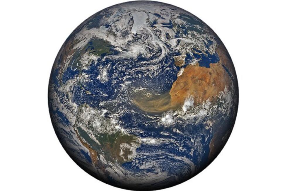
Satellite images have shown the thick dust as a large brown plume moving off the coast of Africa, and then drifting across the Atlantic and then into Caribbean Sea.
The plume is expected to arrive in the Gulf Coast and Florida by the end of the week and possibly along the east coast of the US by this weekend.

According to NASA, “hundreds of millions of tons of dust are picked up from the deserts of Africa and blown across the Atlantic Ocean each year. That dust helps build beaches in the Caribbean and fertilizes soils in the Amazon. It can also affect air quality in North and South America.”
The dust is kicked up by trade winds blowing over the Sahara Desert in Africa. The winds then push these plumes of dust across the Atlantic Ocean. It’s not uncommon for these plumes of dust to travel over 5000 miles from the African Coast to the Gulf Coast of the US.

While these plumes of dust are quite common in June and July, this current plume is one of the largest and thickest in the last 50 to 60 years according to scientists at NASA. Recent observations from Puerto Rico have shown that the amount of dust particles measured in the air is near record levels. The dust has reduced visibility and resulted in hazy skies all across the Caribbean Sea.

Forecast models suggest the dust plume will move into the Gulf of Mexico later this week and then possibly across the east coast of the US by the weekend.

These plumes of dust can cause several changes in the atmosphere across the Atlantic.
The Saharan dust is also accompanied by very dry air. The dry air impedes the thunderstorms needed for tropical storms and hurricanes to form. With the Saharan dust covering much of the Caribben and central Atlantic, tropical activity in those areas is highly likely over the next week to 10 days.
The dust can also lead to more vibrant sunrises and sunsets. While the daytime sky will tend to look very milky and hazy when the Saharan dust in place, the twilight sky can become brilliant. The small dust particles scatter the rays of the sun. The result is often times vibrant sunsets and sunrises with deep hues of orange and red.
Copyright 2020 WMBF. All rights reserved.


