We’d decided, around the fire last night, to have a driving day today, and explore an area to the west where we had not been before.
John went and fuelled up Truck – $1.50cpl here!
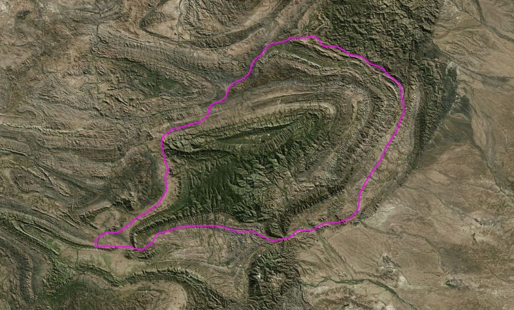
We took the “back” way to the west, towards Umberatana. The plan was to loop around the northern part of the National Park, then at Yankaninna ruins, take the 4WD Idninha Track back east, into the Park and cut through to the Arkaroola road that way, either to Bolla Bollana or further through the Park to the McTaggart Track. It could be a possible circuit of some 100kms.
Did not stop to look at features close to Arkaroola – saved those for another day.
An isolated and unexpected spinifex ring
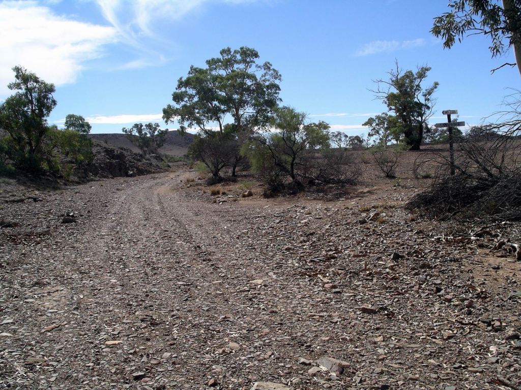
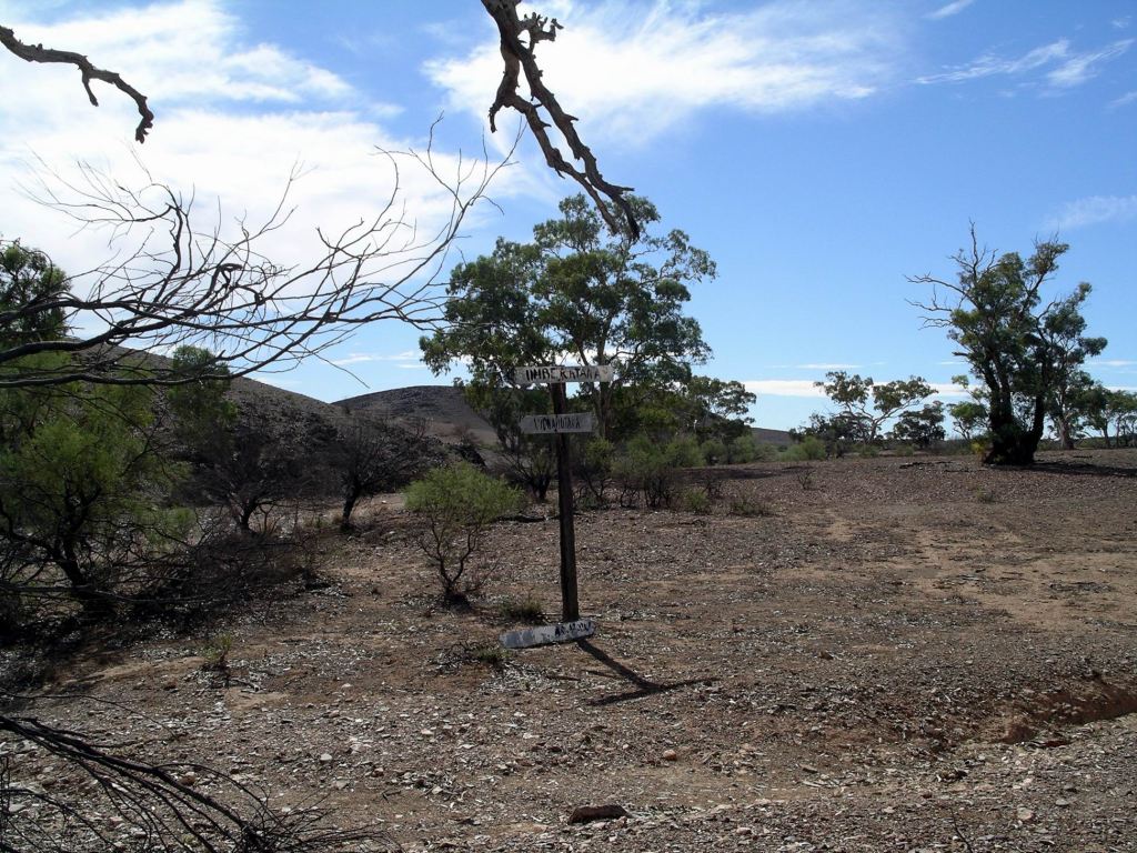
The route was not as much used as we had anticipated. The distances shown on our map were way out, and the roads were not as “important” as the map made them look! They were supposed to be 2WD tracks, but I knew a lot of drivers of same who would freak out if faced with these. Signposting was not great, either, and there was one point somewhere around Umberatana where I was really unsure if we were going the right way.
One of the very few signposts
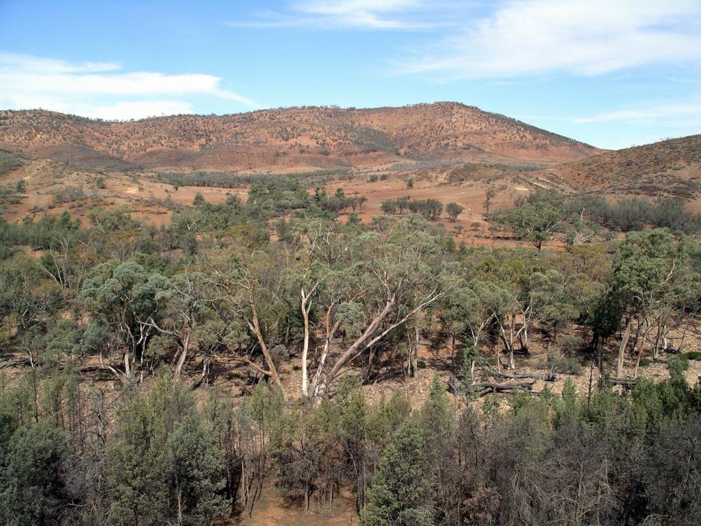
But it was attractive travelling, with the ranges in the distance and with lines of low scrub marking creek lines – dry now, of course. The road undulated, twisted and turned, so there was always a new vista.
Change of road surface on the flats
There were some gates to deal with too.
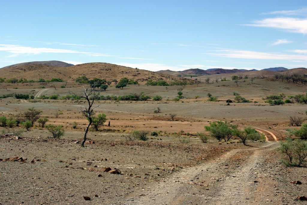
At Yankaninna, we had to invent Plan B, because the track into the National Park was closed. Found out later that the landowner on the western border of the Park did not want people accessing the Park across his property – so he just shut off the road! So, Plan B became to keep on going in a big circuit around the outside of the park – a very much longer drive than we had anticipated. It was either that or go back the way we came, which seemed a bit tame.
The intention was to find the track that passed through those hills….
Stopped for our lunch break at Arcoona Creek – a point where the road we were on brushed against the National Park, and where there was a campground. It would be a pleasant, if remote, place to camp; certainly unlikely to have many, if any, fellow campers. There was shade but no facilities.
Cypress pines at Arcoona Creek
We walked around the place a bit and climbed up a ridge to get a view over the campground, before setting off again.
Arcoona camp area down there
Passed Mt Serle Homestead, then joined the Copley-Balcanoona road, near Angapena and turned east.
Called in at the Iga Warta community store, having decided it would be desirable to have some marshmallows for our campfire. They had some in stock, too.
Both Iga Warta and the Nepabunna comunity appeared clean and well run.
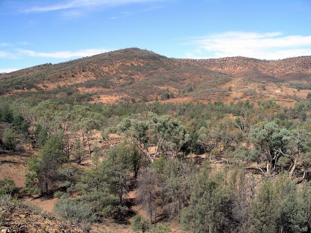
Continuing east, the section of road through Italowie Gap was particularly scenic.
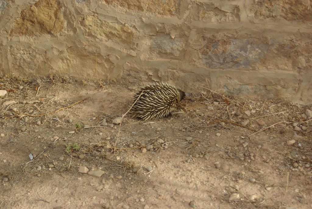
We called in at the National Park Headquarters at Balcanoona, mainly to find out about any other track closures that might be waiting to ambush us. There were none. Came across an echidna there – it was trying hard to pretend we were not there.
It was late afternoon when we got back to camp, having driven some 180kms. Just a little extra adventure, beyond what we had expected.
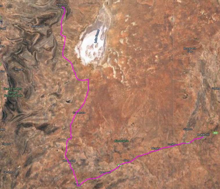
Our approximate route on today’s drive (Zoom)
Spent another evening around our campfire – sampling toasted marshmallows – followed by an early night. After today of sitting and driving, we decided upon a more active day tomorrow.
Today was my son’s 33rd birthday. We’d acknowledged that before we left home.
We packed up and hitched up as efficiently as we could, with a big trip ahead of us today.
It was a long day of driving – on the Barrier Highway to Yunta, then on dirt roads north past Frome Downs Homestead and Balcanoona, and on to Arkaroola. The roads were firm gravel and, for the most part, pretty good to drive on. Some of the sign-posting, or lack thereof, left a bit to be desired.
Topped up the fuel again at Yunta – now, in SA it was $1.29 cpl.
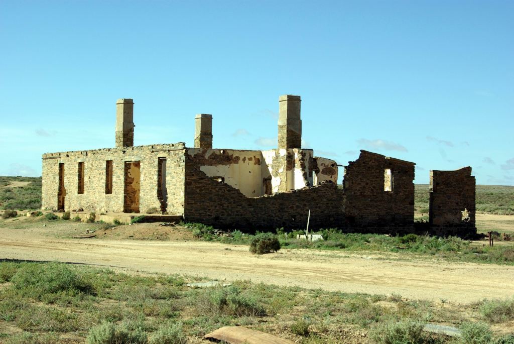
Some 34kms north of Yunta were the Waukaringa ruins. We spent about an hour browsing around these.
Hotel ruins Waukaringa
In the 1880’s, a gold mine was established here and a township grew up rapidly, as tended to happen when there was a promising find. By 1890, it had a population around 500 people. As the gold petered out, the population dwindled. The hotel licence, however, was not surrendered until 1964.
The skeleton of the old hotel was the most obvious ruin, but there were others, plus mining relics, scattered around and up on the low ridge where the actual mines were.
It was evident that the area around the hotel ruins was sometimes used by campers.
Further on, we stopped to eat lunch, near the dry Wilpena Creek ford, just beyond Frome Downs.
Of course, after we started off again, there was a spot that would have been better, with a few trees by another dry creek.
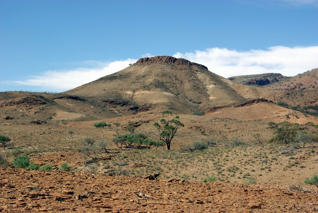
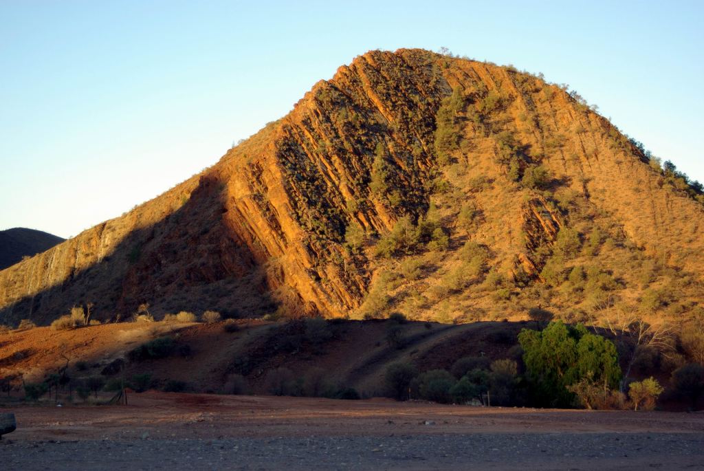
Although we were traversing flat, stony country, in the distance to the west, was the line of the Flinders Ranges.
Flinders Ranges – well to the west of our road.
The road crossed a gas pipeline, from the Moomba gas fields near Innamincka. Here was a bit confusing. A road runs alongside the pipeline and it looked like we should go right, but the correct way was straight ahead. For once, I got it right!
As we progressed north, the flat, barren, stony plains were replaced by more rugged country, with more ranges apparent. This really was an interesting drive. We crossed a number of dry creek beds, many with low trees and scrub growing along them, and then red gums. Essentially, we were skirting the western edge of the dry salt Lake Frome, but at a distance sufficient that we could not see it.
Balcanoona, once a sheep station, is now the base for the Rangers of the Gammon Ranges National Park, which takes in country mostly to its north and west. Arkaroola, where we were heading, is about 30kms north of Balcanoona, and just on the eastern edge of the National Park.
I had hoped to stop at the Ranger Base, to see if I could get any information about the National Park that I didn’t already have, but John wanted to push on. He could see the end to the day’s driving almost in sight!
We got into Arkaroola mid-afternoon, so we had made good time. We parked near the Reception area of the outback resort that is Arkaroola and booked ourselves into their campground. As well as this, they had motel style units and some cabins – so a range of accommodation. The campground was about 500 metres distant from the Village hub.
Our powered site cost $20 a night and, because we booked in for a week, the 7th night was free. M was only charged $15 a night, because she was travelling solo – so many places will not make that concession, even though it seems fair. John and I had visited Arkaroola a few times previously – it was a place we loved – but this was a first for M. Hence the longer stay.
We had a pleasant area, designed to take two outfits, on the top level of the tiered campground, with a great view across the very scenic area to Griselda Hill and the surrounding ranges. The camp ground felt very much as if it was in a pocket, surrounded by stark and rugged hills.
Griselda Hill, from our camp
The campground was gravel surfaced, as one would expect in such an arid area.
Our site had a fire pit and BBQ plate and there was a bore water tap. We did not hook up to the latter, as we preferred the better quality of our own tank water, but filled containers from it for washing up. The nearby amenities were dated and basic, but spacious and clean. Let’s face it – really, all one needs are a clean and functional toilet and shower. Frills are able to be dispensed with.
We set up for our extended stay. The afternoon wind made putting up M’s living tent a bit tricky. We needed the 4 inch masonry nails that John carries, to anchor the tent ropes in the rock hard ground. From memory, it was actually one of our earlier tent based camping trips to Arkaroola, that got him into the habit of carrying the masonry nails – for places like this where tent pegs just did not have a hope!
Whilst M slept in the Troopy, it was not set up inside as a camper. For overnight stops she made do with her camp stove on a small folding table, but when staying longer, set up a tent for cooking and living in. This system had evolved over the previous couple of years of travel, but she was yet to get the right mix of convenience and comfort. A work in progress.
The van had travelled well. With the pressure scoop hatch open, and cardboard taped across the vent in the lower door, very little dust had gotten inside, though we’d done about 300kms on dry and dusty surfaces.
Almost immediately upon arrival at our site, M’s front tyre went flat. After setting up, we changed it and she took it up to the resort complex to the mechanic facility there, for repair.
We sat outside together, to eat tea, and stayed there for a while, after. We hadn’t thought to gather firewood on the latter part of the drive here, but would rectify that sometime soon.
Arkaroola Resort complex at top, campground lower left, showing formal sites, with large unstructured camp area beyond it. (Zoom)
Unseen by us, the full moon rose behind us, but we were busy admiring the myriad of stars spread out above us. The skies here were so clear that Arkaroola has two proper astronomical observatories.
We finally felt like we were getting away from the rat race again!
Arkaroola has an interesting history. It sits in the midst of a really ancient landscape, buckled and tortured over time. Some of the geological structures here are 1.6 billion years old, pre-dating animal life on Earth. Europeans moved into the area in the 1860’s, chasing copper, as happened in other parts of SA too. As was common, the mines did not last long, but their relics are dotted about the area now.
From the early 1900’s, it was a sheep run, in very marginal country.
The ancient rocks of Arkaroola contain unusually formed radioactive deposits and “hot rocks”. Uranium was found and briefly mined from 1910 – with great difficulty given the terrain. The events of WW2 led to a revival of uranium exploration and mining on Arkaroola.
In 1968, the Arkaroola Pastoral Lease was bought by the Sprigg family, with the aim of setting up a Wilderness Sanctuary. The very interesting and talented geologist, Reg Sprigg had visited the area with mineral survey parties and with (Sir) Douglas Mawson of Antarctica fame. He became convinced of the unique nature of the area and the need to act to conserve it. Back then, such private sanctuaries were unusual, but the government of SA was not prepared to buy the property. A huge effort was then made to get rid of the feral animals that infested the place and threatened both its fauna and flora. The development of the tourism aspect of Arkaroola was a means of partly funding the place, but also showing visitors its special qualities. The Sprigg family still runs Arkaroola.
In this region, of course, the Flinders Ranges and Wilpena Pound are the best known tourist destination. The more rugged and arid Arkaroola and Gammon Ranges are much less visited – in part, because of the unsealed access roads, in part perhaps because visitors assume they have “done” the Flinders Ranges and hence there is no need to look further. They don’t know what a superb area they are missing!