Lake Pedder
In the cosy sitting room of Pedder Wilderness Lodge in Strathgordon there was a book. I kept looking at it, even though I realised that, each time I picked it up, it was changing what I thought about where I was, and my reason for being there.
The book, Lake Pedder, compiled by Bob Brown and Kevin Kiernan, who supplied the photographs, is no longer available, except perhaps in secondhand book shops. It tells the story of the destruction of one of this continent's special places; the struggle of those people who were compelled to try to save it from inundation; and the pervading feeling after the deed was done, and its legacy.
Certain places have a magic about them that attracts pilgrims. I would venture to suggest that Byron Bay is one such. Many people theorise as to why this happens: unrivalled, unspoilt beauty; a spiritual connection; ley lines; an alternative culture? Who knows?
Once I learned about the original Lake Pedder in Tasmania's western wilderness, I missed it. Even though I'd never been.
Between Strathgordon and the Gordon Dam, White Spur Lookout reveals some of its 'enlarged' replacement. It's a great view. I have, however, never felt that manmade lakes cut the mustard. This is what dead drowned trees look like below a high water mark no longer achieved in neighbouring Lake Gordon. I would describe this landscape as forlorn.

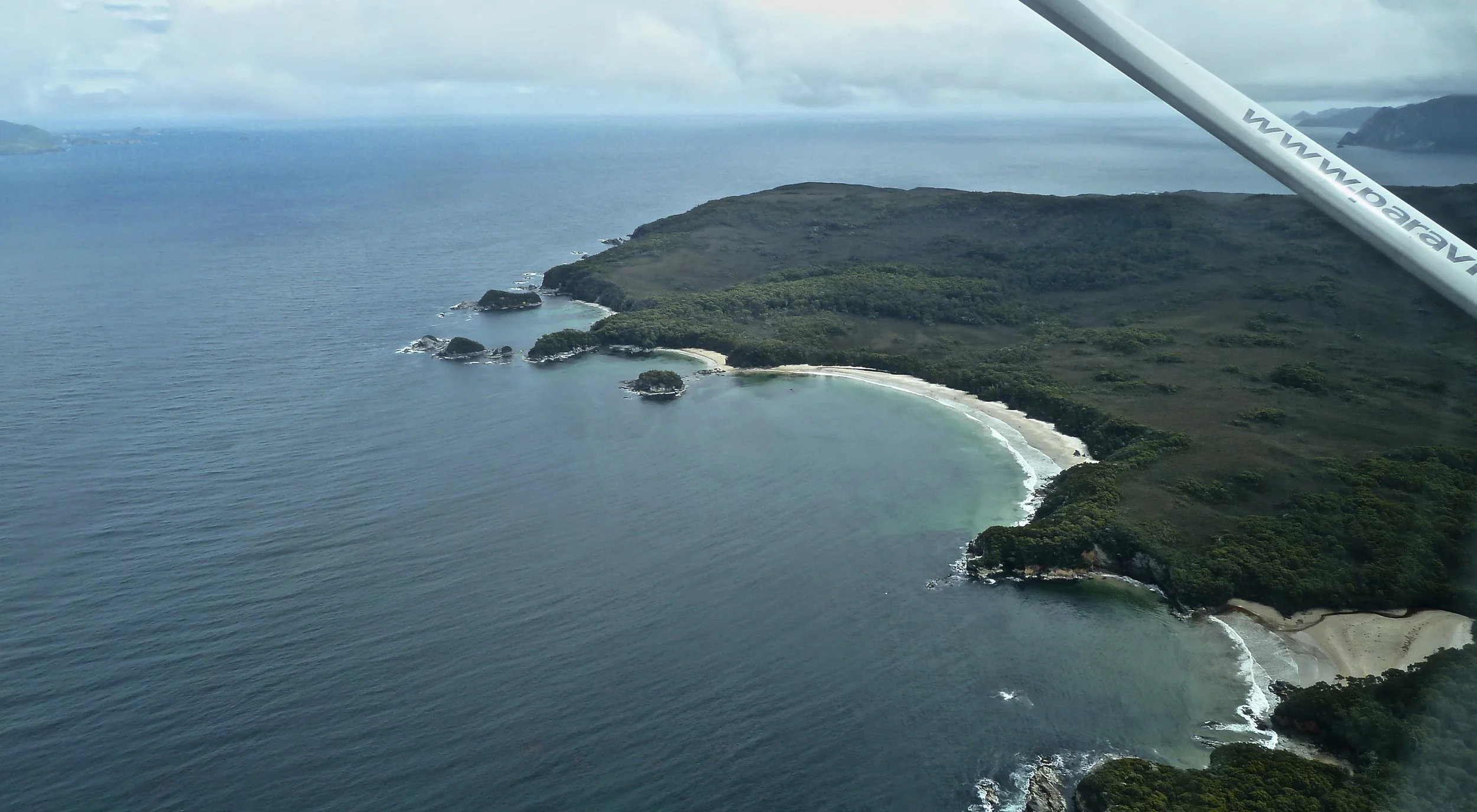
Anyway, back to the nice view (below)… Straight ahead in the distance is the Frankland Range, made of Precambrian quartzite, among the oldest rocks in Tasmania. The landforms derive from glacial erosion: the debris from this process dammed the Serpentine River, creating the original, much smaller Lake Pedder, which we wouldn't have been able to see from here.
In the 1820s and '30s, surveyors cut tracks through the southwest. John Wedge was searching for the source of the Huon River when he found Lake Pedder (which he named after the Chief Justice at the time).
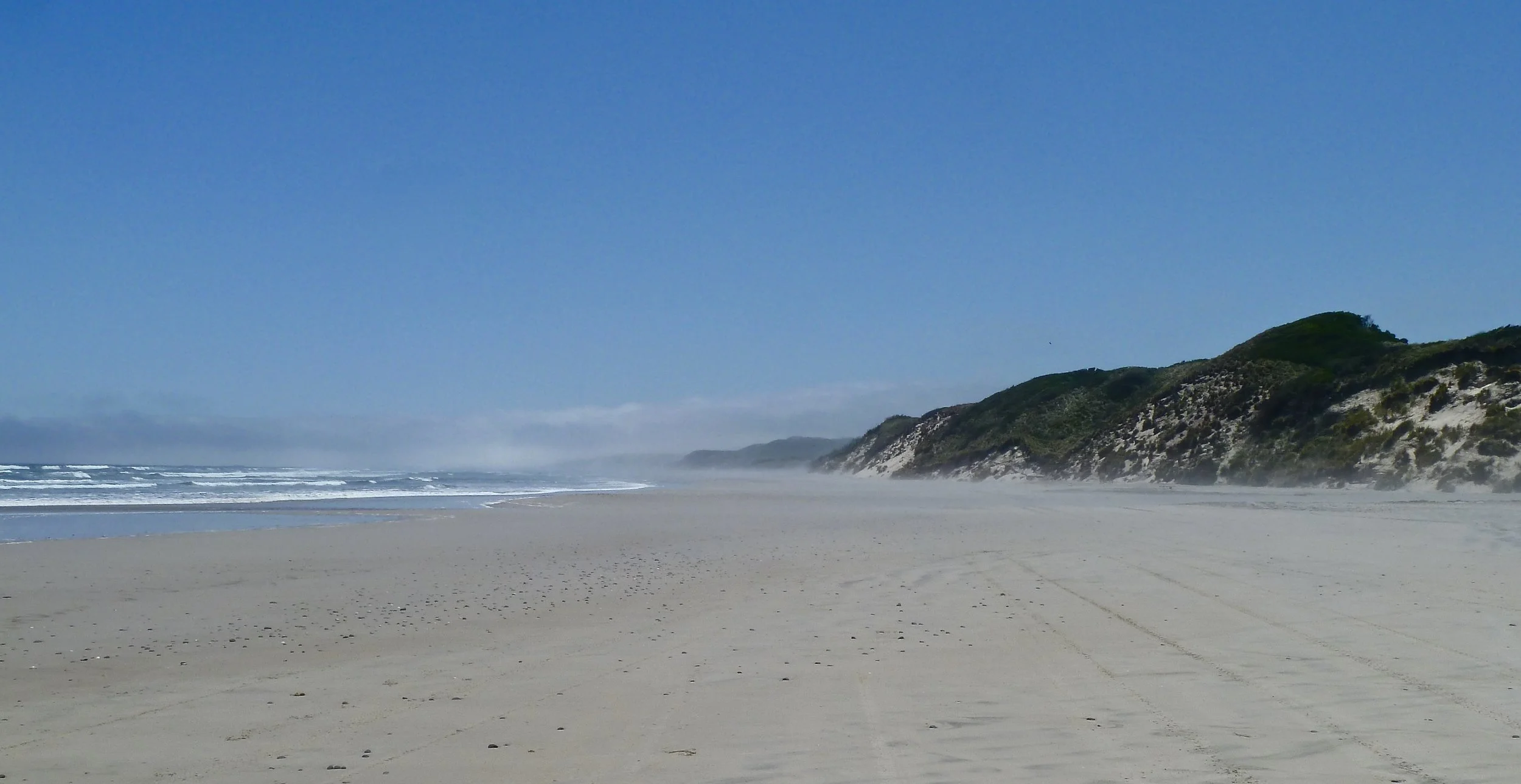
For a century, Lake Pedder was known only to those prepared to hike along surveyors' tracks from Maydena. By the 1940s, light planes could land visitors on a spectacular pale-sand beach along the Lake's eastern shore: tourism had arrived. They were rewarded by amber waters coloured by run-off from peaty, buttongrass plains. The Roaring Forties and wave action had created dunes up to 20 metres high, in places populated by Peppermint, Tea Tree, Silver Banksia and Melaleuca. Visitors might have spotted wombats, Tasmanian Devils, marsupial mice, possums, wallabies, quolls, tiger cats, platypuses, black swans, ground parrots and emu-wrens. Some creatures were found nowhere else on earth: caddis flies, shrimps, snails, aquatic worms, crayfish, and the Pedder Trout*.
Following lobbying by bushwalkers, 24,000 hectares of Lake and its surrounds was declared a National Park in 1955.
Within a year, what was then the Hydro-Electric Commission of Tasmania was looking to harness power using the southwest region's 250 cm of annual rainfall. The Commissioner of The Hydro, as it was known, was also a member of the Scenery Preservation Board that had proclaimed the National Park, and in 1961 he made reassuring noises that 'the possibility of power development in this area in the foreseeable future is remote.' What he didn't reveal was that flow recorders had been installed on the region's rivers as early as 1953. Serious concern started to develop in 1963 when the state government made a submission to the federal government for funds to build a road from Maydena into the heart of the wilderness. They were successful. Within two years Premier Eric Reece conceded that there was going to be 'some modification' to Lake Pedder National Park.
In 1967, electricity rationing following an eight-month drought – and bushfires that claimed 1300 homes and 62 lives in Hobart's suburbs alone – made the HEC nervous about supply and the government receptive to the idea of new dams. In May that year, 'some modification' became the drowning of Lake Pedder to create nearly 250 square kilometres of impoundment by damming the Huon and Serpentine rivers to the east and west of the Lake. Pedder was being 'enlarged', the HEC explained. In fact, an enormous sacrifice was about to be made so that merely the top 1.7 metres of a bigger lake could be channelled north into a second impoundment in the middle reaches of the Gordon River, from which electricity would be generated.
Much later it was revealed that a smaller storage could have been created on the Serpentine River and connected to the powerhouse by tunnel, thus avoiding the flooding of Lake Pedder altogether. Pedder was to be destroyed in order to capture the flow of the Huon River – a mere 12 per cent of the total water involved in the scheme – in the cheapest way possible.
There was a huge initial outcry in 1967, beginning with a petition of 10,000 signatures, the largest in Tasmanian history. The upper house of government established a Select Committee to investigate, but neither the HEC nor the government saw fit to await its findings, instead introducing legislation to spend $95 million on the development. Two years later Reece lost power. The Bethune government that followed set up the National Parks & Wildlife Service. But Lake Pedder's fate was already sealed. On one weekend alone in the summer of 1971, more than 1000 people visited the Lake while they still could. A few of them flew in, but most walked 20 kilometres along one of two tracks to get there.
The campaign to save Lake Pedder lasted seven years. By 1972 the Edgar, Serpentine and Scots Peak dams had been constructed. As winter rains began to fill up the new Lake Pedder to 24 times the size of the old one, those who had fought set up a vigil camp on the dunes, to monitor the rising waters and rescue wildlife from drowning. The activists stayed until only the crests of the dunes remained uncovered. Right up until the end, debate continued between the old guard of the Tasmanian government and new thinkers about whether or not the scheme should proceed. Among campaigners, tears were shed as hope was lost; bitterness grew; some turned their attention to the next battle, for the Franklin River; and the world's first environmental political party was formed.
Recriminations and repercussions continued, and do so to this day. Some have never given up hope that (little) Lake Pedder can be resurrected. In 1995 a federal government enquiry concluded that it was possible to drain the new lake but that the cost would be prohibitive. The people for whom Lake Pedder was a temple, still dream. One of them, Kevin Kiernan, is now a lecturer in Geomorphology at the University of Tasmania. Last year he wrote about the fact that conditions have changed since 1995, and makes a strong case for the restoration of 'the crown jewel and centrepiece of the Tasmanian wilderness'.
Olegas Truchanas also knew the original Pedder better than most. He died 'in action' on the Gordon River in 1972. You can't miss his words if you visit Strahan's tourist information office. They ring truer than ever today.
As we drove from Strahan to Lake Pedder, my ignorance of the true jewel in the crown of the western wilderness was almost total. By the time I read the book we had already visited, and admired, the Gordon Dam, an impressive feat of engineering, especially considering its remoteness.
The two kilometre long gorge it dams is deep and narrow. The dam is a concrete arch dam with a double curve: from side to side, and from top to bottom. Arch dams require fewer materials to hold back the water: the curves transfer the load into the rock walls and foundations. The power station is underground in a huge cavern, 96 metres long by 22 metres wide by 28 metres high. Water from the reservoir is delivered via the intake shaft at the edge of the lake to three 150 MW Francis turbines in the cavern. Electricity generated is conducted to the control building at the surface, and thence via transformers, a switchyard and transmission lines to Tasmania's grid.
We walked along the top of the dam, in occasional rain, observing crazy abseilers descending into the abyss. I hope the experience was worth what looked like many hundreds of rungs on the way back up by means of caged ladders. A damp resident Currawong was in the thick it.
The day was grey and drizzly, but the colours of the quartzite and gneiss were rich, while dark-coloured water against rock produced nice graphics.
Note the drill holes for blasting
By the time we got back to Strathgordon, the sun was breaking through and modern Lake Pedder looked rather beautiful.
The day we arrived it had disappointed. We knew it wasn't a natural lake, and without sun it looked particularly lifeless. It grew on me, however, over the next three days, in its different moods.
On the way from Strahan, our first stop was Queenstown. The region's rich mining history was in evidence before we hit town.
The pit of Queenstown's old Iron Blow copper mine
We travelled back east along the Lyell Highway, as the sun deserted us and we climbed up misty highlands. Seven kilometres beyond Ouse, we cut southeast on the C608 to join the Gordon River Road. At Westerway we bought freshly picked raspberries. The road was almost busy through the Tyenna Valley, but thankfully the rest turned off for Mount Field National Park, which has skiing in winter, walking in summer… and thylacine sightings. We didn't need Mount Field, however. Beyond Maydena, there was nothing, except a welcome sign and some beautifully wild-looking country.
After the Gordon Dam visit, we walked up the Twelvetrees Range: the track is the diagonal line up the hillside in the image below.
They told us later at Pedder Wilderness Lodge that it was six kilometres, up to the top and back. It didn't seem that far, except at the end when we rushed against the weather closing in. There were constant distractions from the climb in the form of wildflowers, rocks and vistas in ever-changing light. We didn't meet a soul. It was wonderful.
The following day the weather wasn't good, with rain off and on. We relaxed and read a lot in the comfy room. There was a short rainforest walk in Strathgordon, which in a former life was the construction village for the Gordon Dam. The walk was the most significant activity of the day.
It was New Year's Eve, although days in the wilderness are indistinguishable. Pedder Lodge went to some trouble, laying on a barbecue, a great cover band and, at midnight, what can only be described, given the context, as a spectacular firework display over the Lake.
We left for Hobart the following morning. The visibility was poor, but the stillness produced the best reflections since our arrival. I'd enjoyed Strathgordon but my feelings were ambivalent. Lake Pedder was a destination on our Tasmanian tour to reconnect with the Gordon River, 50 kilometres upstream of Macquarie Harbour this time…
The Gordon River just below the Gordon Dam (left) and where it enters Macquarie Harbour (above)
…And to commune with more western wilderness. I had a massive problem, however, with the manmade intervention here, and I wonder if we'd ever have come had I known the full story. Wherever I am, I'll find images to take away and treasure, and this was no exception. Imagine, though, what they might have been if, four decades ago, those deciding the fate of the original Lake Pedder had cared a little more about a beautiful legacy. I couldn't get out of my head the wondrous sights I was missing.
Green Rosella
Down the road was the McPartlan Pass where a canal transports water from the Lake Pedder impoundment to Lake Gordon. A sign boasted that the two lakes form Australia's biggest water storage. The dark water moved swiftly and silently. The transmission lines from the Gordon Power Station completely ruined my picture, which just about summed things up.
* I acknowledge the authors of Pedder Lake for some of the details in my description of fauna and flora and the history of a remarkable place.