EP1355283A1 - Positional information management system and method - Google Patents
Positional information management system and method Download PDFInfo
- Publication number
- EP1355283A1 EP1355283A1 EP03008034A EP03008034A EP1355283A1 EP 1355283 A1 EP1355283 A1 EP 1355283A1 EP 03008034 A EP03008034 A EP 03008034A EP 03008034 A EP03008034 A EP 03008034A EP 1355283 A1 EP1355283 A1 EP 1355283A1
- Authority
- EP
- European Patent Office
- Prior art keywords
- acceleration
- data
- positional
- positional information
- mobile terminal
- Prior art date
- Legal status (The legal status is an assumption and is not a legal conclusion. Google has not performed a legal analysis and makes no representation as to the accuracy of the status listed.)
- Granted
Links
Images


Classifications
-
- G—PHYSICS
- G01—MEASURING; TESTING
- G01S—RADIO DIRECTION-FINDING; RADIO NAVIGATION; DETERMINING DISTANCE OR VELOCITY BY USE OF RADIO WAVES; LOCATING OR PRESENCE-DETECTING BY USE OF THE REFLECTION OR RERADIATION OF RADIO WAVES; ANALOGOUS ARRANGEMENTS USING OTHER WAVES
- G01S5/00—Position-fixing by co-ordinating two or more direction or position line determinations; Position-fixing by co-ordinating two or more distance determinations
- G01S5/0009—Transmission of position information to remote stations
- G01S5/0018—Transmission from mobile station to base station
-
- G—PHYSICS
- G01—MEASURING; TESTING
- G01C—MEASURING DISTANCES, LEVELS OR BEARINGS; SURVEYING; NAVIGATION; GYROSCOPIC INSTRUMENTS; PHOTOGRAMMETRY OR VIDEOGRAMMETRY
- G01C21/00—Navigation; Navigational instruments not provided for in groups G01C1/00 - G01C19/00
- G01C21/10—Navigation; Navigational instruments not provided for in groups G01C1/00 - G01C19/00 by using measurements of speed or acceleration
- G01C21/12—Navigation; Navigational instruments not provided for in groups G01C1/00 - G01C19/00 by using measurements of speed or acceleration executed aboard the object being navigated; Dead reckoning
- G01C21/16—Navigation; Navigational instruments not provided for in groups G01C1/00 - G01C19/00 by using measurements of speed or acceleration executed aboard the object being navigated; Dead reckoning by integrating acceleration or speed, i.e. inertial navigation
-
- G—PHYSICS
- G01—MEASURING; TESTING
- G01S—RADIO DIRECTION-FINDING; RADIO NAVIGATION; DETERMINING DISTANCE OR VELOCITY BY USE OF RADIO WAVES; LOCATING OR PRESENCE-DETECTING BY USE OF THE REFLECTION OR RERADIATION OF RADIO WAVES; ANALOGOUS ARRANGEMENTS USING OTHER WAVES
- G01S19/00—Satellite radio beacon positioning systems; Determining position, velocity or attitude using signals transmitted by such systems
- G01S19/01—Satellite radio beacon positioning systems transmitting time-stamped messages, e.g. GPS [Global Positioning System], GLONASS [Global Orbiting Navigation Satellite System] or GALILEO
- G01S19/03—Cooperating elements; Interaction or communication between different cooperating elements or between cooperating elements and receivers
- G01S19/09—Cooperating elements; Interaction or communication between different cooperating elements or between cooperating elements and receivers providing processing capability normally carried out by the receiver
-
- G—PHYSICS
- G01—MEASURING; TESTING
- G01S—RADIO DIRECTION-FINDING; RADIO NAVIGATION; DETERMINING DISTANCE OR VELOCITY BY USE OF RADIO WAVES; LOCATING OR PRESENCE-DETECTING BY USE OF THE REFLECTION OR RERADIATION OF RADIO WAVES; ANALOGOUS ARRANGEMENTS USING OTHER WAVES
- G01S19/00—Satellite radio beacon positioning systems; Determining position, velocity or attitude using signals transmitted by such systems
- G01S19/38—Determining a navigation solution using signals transmitted by a satellite radio beacon positioning system
- G01S19/39—Determining a navigation solution using signals transmitted by a satellite radio beacon positioning system the satellite radio beacon positioning system transmitting time-stamped messages, e.g. GPS [Global Positioning System], GLONASS [Global Orbiting Navigation Satellite System] or GALILEO
- G01S19/42—Determining position
- G01S19/48—Determining position by combining or switching between position solutions derived from the satellite radio beacon positioning system and position solutions derived from a further system
- G01S19/49—Determining position by combining or switching between position solutions derived from the satellite radio beacon positioning system and position solutions derived from a further system whereby the further system is an inertial position system, e.g. loosely-coupled
-
- G—PHYSICS
- G01—MEASURING; TESTING
- G01S—RADIO DIRECTION-FINDING; RADIO NAVIGATION; DETERMINING DISTANCE OR VELOCITY BY USE OF RADIO WAVES; LOCATING OR PRESENCE-DETECTING BY USE OF THE REFLECTION OR RERADIATION OF RADIO WAVES; ANALOGOUS ARRANGEMENTS USING OTHER WAVES
- G01S5/00—Position-fixing by co-ordinating two or more direction or position line determinations; Position-fixing by co-ordinating two or more distance determinations
- G01S5/02—Position-fixing by co-ordinating two or more direction or position line determinations; Position-fixing by co-ordinating two or more distance determinations using radio waves
- G01S5/0284—Relative positioning
-
- G—PHYSICS
- G08—SIGNALLING
- G08G—TRAFFIC CONTROL SYSTEMS
- G08G1/00—Traffic control systems for road vehicles
- G08G1/01—Detecting movement of traffic to be counted or controlled
- G08G1/0104—Measuring and analyzing of parameters relative to traffic conditions
Definitions
- the present invention relates to a positional information management system and a positional information management method for use in managing positional information of a worker who moves from place to place toward the visiting destination where he/she has tasks to do, and a recording medium and a mobile terminal therefor.
- a worker who goes out from his/her office to perform his/her job writes a daily report in which the contents of works he/she has done at the visiting place are put down.
- the location of the visiting place and how to travel are also included in this daily report, so that transportation costs may be paid back to the worker based on the reported information.
- the worker has to report to the company the means of transportation he/she utilized and the stations he/she got on/off the transportation.
- the worker may utilize a positional information providing service offered by a communication service company, by using his/her cellular phone, etc. Specifically, the worker regularly sends his/her current position to the company's management system on this positional information providing service. Then, the worker specifies the route he/she took including the utilized means of transportation and the stations to get on/off the transportation based on the positional information sent to the system, and generates the daily report based on the specified information.
- the positional information providing service can not be accessed from indoor environments such as inside the subways and buildings where communication condition is poor. In these cases, the positional information can not be properly recorded and the route the worker took can not be accurately traced.
- the present invention was made to solve the above-described problems, and an object of the present invention is to provide a positional information management system, a positional information management method, and a mobile terminal which are capable of efficiently managing positional information of a worker who moves from place to place toward the visiting destination where he/she has tasks to do.
- a positional information management system is a positional information management system comprising: a mobile terminal which acquires acceleration data at a predetermined position; a management server which is connected to the mobile terminal through a network and predicts a travel route of the mobile terminal; and a communication system which specifies a current position of the mobile terminal and sends positional data representing the specified current position to the management server, wherein the management server (21):
- the management server (21) may further be connected to a motion pattern data storage unit (24) which stores a velocity pattern and an acceleration pattern for each means of transportation, and may specify means of transportation used for traveling between the two positions, by deriving an average travel velocity between the two positions based on the selected positional data and their reception times and then comparing the average travel velocity with the velocity pattern stored in the motion pattern data storage unit (24), or by comparing the extracted acceleration log with the acceleration pattern stored in the motion pattern data storage unit (24).
- a motion pattern data storage unit (24) which stores a velocity pattern and an acceleration pattern for each means of transportation, and may specify means of transportation used for traveling between the two positions, by deriving an average travel velocity between the two positions based on the selected positional data and their reception times and then comparing the average travel velocity with the velocity pattern stored in the motion pattern data storage unit (24), or by comparing the extracted acceleration log with the acceleration pattern stored in the motion pattern data storage unit (24).
- a positional information management method for predicting a travel route from a notification point at which a mobile terminal should notify that it is at the point, based on positional data representing a current position of the mobile terminal which acquires acceleration data at a predetermined position, and an acceleration log representing acceleration data in time series acquired by the mobile terminal, the positional data and the acceleration log being notified through a predetermined network, the method comprising:
- the positional information management method may further comprise a step of storing map data representing predetermined means of transportation, and places to get on and off the means of transportation, the notification point may include the places to get on and off the means of transportation, and the step (S27) of predicting the travel route may include specifying means of transportation which includes the notification point in its running course, by using the map data.
- the step (S27) of predicting the travel route may include a step (S25) of specifying the notification point based on the extracted acceleration log corresponding to the selected positional data and the selected positional data, in a case where any of the selected positional data is not positional data representing the notification point (S22), and a step (S23, S26) of predicting the travel route based on positional data representing the notification point or based on the extracted acceleration log.
- the position recorded in the positional data storage means differs from the notification point at which the mobile terminal should notify its presence.
- a travel route can be predicted because the position of the notification point is specified based on the acceleration log and the positional data.
- the step (S25) of specifying the notification point may specify the notification point by:
- the notification point at which the mobile terminal should notify its presence can be predicted.
- the positional data management method may further comprise a step of storing a velocity pattern for each predetermined means of transportation, and the step (S27) of predicting the travel route may specify means of transportation by calculating an average travel velocity between the two positions based on the selected positional data and the times at which the positional data are notified, and by comparing the average travel velocity with the velocity pattern (S23).
- a travel route can be predicted more accurately, since different means of transportation have different velocity patterns.
- the positional information management method may further comprise a step of storing an acceleration pattern for each predetermined means of transportation, and the step (S27) of predicting the travel route may specify means of transportation by comparing the extracted acceleration log with the acceleration pattern (S26).
- a travel route can be predicted more accurately, since different means of transportation have different acceleration patterns.
- a program for controlling a computer to execute all or a part of the above-described steps can be provided by recording the program in a computer-readable recording medium, or by carrying the program on a carrier wave which can be run on a computer.
- a mobile terminal which comprises: an acceleration measuring unit which senses an acceleration and measures an acceleration log; a positional information acquiring unit which acquires predetermined positional information; a control unit which controls the acceleration measuring unit and the positional information acquiring unit; and a storage unit which stores predetermined data, and which sends predetermined information to a management system for managing the positional information, wherein the control unit (11):
- the management system can manage the positional information of the mobile terminal speedily.
- the control unit (11) may further derive a time cycle as a function of an acceleration measured by the acceleration measuring unit (13), and send data regarding the position of the mobile terminal (10) to the management system (20) in accordance with the time cycle.
- data regarding the position of the mobile terminal can be sent to the management system efficiently, in accordance with the travel condition of the mobile terminal.
- a positional information management system a positional information management method, a recording medium, and a mobile terminal which are to be used in order to manage business trips of a worker who moves from place to place toward a plurality of visiting destinations where the worker has tasks to perform.
- the worker is supposed to visit a plurality of business partners' places by utilizing various means of transportation, while reporting positional information to his/her company.
- the positional information is used when a daily report in which how to travel from one business partner's place to another is put down is to be generated. Payback of the transportation costs, etc. will be done based on this daily report.
- a cellular phone terminal 10 as a mobile terminal shown in FIG. 1 is offered to the worker.
- the worker visits the business partners' places, etc. carrying the cellular phone terminal 10.
- a terminal identifier for identifying each terminal is assigned to the cellular phone terminal 10.
- the cellular phone terminal 10 comprises a GPS signal reception unit 12, an accelerometer 13, an acceleration data storage unit 14, and a control unit 11 for controlling these units.
- the cellular phone terminal 10 has a notification button (not shown) for performing a later-described notification process.
- the control unit 11 controls the GPS signal reception unit 12 and the accelerometer 13, and has a function for performing wireless communication with a later-described communication system 30.
- the cellular phone terminal 10 further has a terminal function for transferring GPS signals received by the GPS signal reception unit 12 to the later-described communication system 30 for enabling utilization of a positional information providing service offered by the communication system 30, in order to specify its position.
- the control unit 11 has a function as a clock for indicating the current time.
- the GPS signal reception unit 12 receives a radio wave (a GPS signal) from a predetermined GPS (Global Positioning System) satellite.
- the accelerometer 13 measures the acceleration applied to the cellular phone terminal 10.
- the acceleration data storage unit 14 stores data on the acceleration applied to the cellular phone terminal 10 in time series.
- the communication system 30 is a system including a wireless base station for sending and receiving predetermined information to and from the cellular phone terminal 10.
- the communication system 30 specifies the position of the cellular phone terminal 10 based on GPS signals sent from the cellular phone terminal 10, and relays communications between a management system 20 and the cellular phone terminal 10.
- the communication system 30 is connected to the management system 20 via a network N.
- a cellular phone net is used as the network N in this embodiment.
- the communication system 30 specifies the position of the cellular phone terminal 10 by using GPS signals. Specifically, the cellular phone terminal 10 transmits GPS signals received from a plurality of GPS satellites to the communication system 30. The communication system 30 specifies the position of the cellular phone terminal 10 using the GPS signals from the plurality of GPS satellites transmitted from the cellular phone terminal 10 in accordance with, for example, triangulation.
- the GPS signals to be used are not limited to signals from three GPS satellites that are necessary for triangulation, but an arbitrary number of GPS signals can be used.
- the management system 20 is a computer system for managing the positional information of the worker.
- the management system 20 performs various processes while exchanging predetermined information with the cellular phone terminal 10 via the communication system 30.
- the management system 20 stores positional information sent thereto and specifies the travel route the worker took.
- the management system 20 includes a management computer 21, as shown in FIG. 1.
- the management computer 21 includes control means (CPU), storage means (a RAM, a ROM, a hard disk, etc.), input/output means, and data sending/receiving means (all of which are not illustrated).
- the management computer 21 executes a positional information management program for performing later-described steps for positional information management (a step of extracting positional data of two positions, a step of extracting acceleration logs, a step of predicting a travel route, etc.).
- This program is recorded on an arbitrary computer-readable recording medium such as a flexible disk, a CD-ROM, etc. to be served for use. Or, this program may be transmitted on a carrier wave which can be run on a computer, so that the program may be used.
- the management computer 21 functions as means for extracting positional data of two positions, means for extracting acceleration logs, means for predicting a travel route, etc.
- a positional data storage unit 22, an acceleration data storage unit 23, and a motion pattern data storage unit 24 are connected to the management computer 21.
- the positional data storage unit 22 stores positional data 220 regarding the position of the cellular phone terminal 10.
- the positional data 220 is recorded when notification of positional information is received from the cellular phone terminal 10.
- the positional data 220 is generated for each notification reception, and includes data on a terminal identifier, a notification reception time, and a position.
- Data regarding an identifier assigned to the cellular phone terminal 10 for specifying the worker who has sent the positional information is recorded in the data area for terminal identifier.
- the phone number of the cellular phone terminal 10 is used as the terminal identifier.
- Data regarding the time at which notification of the positional information is received from the cellular phone terminal 10 is recorded in the data area for notification reception time.
- Data regarding the position of the worker at the time of notification is recorded in the data area for position.
- the data regarding the position of the worker is positional data obtained based on GPS signals which are received by the communication system 30 from the cellular phone terminal 10.
- longitude/latitude data is used as the positional data.
- the acceleration data storage unit 23 stores acceleration data 230 regarding logs of accelerations applied to the cellular phone terminal 10 of the worker.
- the acceleration data 230 is recorded when acceleration data is received from the cellular phone terminal 10.
- the acceleration data 230 is structured to include data regarding a measurement start time, a measurement end time, and an acceleration log in association with the terminal identifier.
- Data regarding an identifier assigned to the cellular pone terminal 10 which has sent the acceleration data is recorded in the data area for terminal identifier.
- Data regarding the time at which the cellular phone terminal 10 starts measuring the acceleration is recorded in the data area for measurement start time.
- the cellular phone terminal 10 starts measuring the acceleration in a case where the cellular phone terminal 10 can not receive GPS signals when the worker tries to perform the process for notifying the positional information, or in a case where the cellular phone terminal 10 can not communicate with the communication system 30.
- Data regarding the time at which the cellular phone terminal 10 of the worker finishes measuring the acceleration is recorded in the data area for measurement end time.
- This acceleration log includes changes in the acceleration from the measurement start time to the measurement end time.
- the motion pattern data storage unit 24 pre-stores motion pattern data 240 for specifying the means of transportation utilized by the worker.
- the motion pattern data 240 indicates the characteristics of the motion pattern of each means of transportation.
- the motion pattern data 240 is structured to include data regarding a transportation identifier, an acceleration pattern, and a velocity pattern for each kind of transportation.
- Data regarding an identifier for specifying means of transportation is stored in the data area for transportation identifier.
- the means of transportation includes travel means such as train, bus, airplane, etc.
- Data regarding an acceleration pattern of each means of transportation is stored in the data area for acceleration pattern.
- the acceleration pattern is represented by, for example, an acceleration time, etc.
- the acceleration time of a train is set longer than that of a bus.
- Data regarding a velocity pattern of each means of transportation is stored in the data area for velocity pattern.
- the velocity pattern is represented by, for example, an average velocity, a velocity range, a running time interval, etc.
- the velocity range of a train is set wider than that of a bus.
- the running time interval of a train is set longer than that of a bus.
- the management system 20 has map data storage means (not shown) for storing map data indicative of predetermined nodes (stations, bus stops, etc.) and each means of transportation.
- the management computer 21 of the management system 20 searches out a corresponding node based on predetermined positional data and/or an acceleration log received from the cellular phone terminal 10, and extracts the name of a possible means of transportation.
- This process is executed by the control unit 11 of the cellular phone terminal 10 in a case where the worker pushes the notification button set on the cellular phone terminal 10.
- node While on duty outside, the worker pushes the notification button at each point (hereinafter referred to as "node”) at which the worker should notify that he/she is at the point.
- a node means a marking point in the travel course, and includes a place such as a station, etc. at which the worker uses a transportation service.
- the node includes the position of a departure station, the position of an arrival station, the position of a bus stop from which the worker gets on a bus, the position of a business partner's place, etc.
- the cellular phone terminal 10 detects a communication condition (step S11).
- This communication condition includes a condition for receiving GPS signals and a condition for communicating with the communication system 30.
- the control unit 11 determines whether or not the GPS signal reception unit 12 has received GPS signals, and whether or not the cellular phone terminal 10 is within a range accessible to the communication system 30.
- the control unit 11 transfers the GPS signals received by the GPS signal reception unit 12 to the communication system 30 (step S13). Data regarding the terminal identifier is affixed to the GPS signals to be transferred.
- the communication system 30 specifies the position of the cellular phone terminal 10 based on the received GPS signals, generates data (positional data) regarding the specified position. Then, the communication system 30 sends notification data including the generated positional data and the terminal identifier to the management computer 21 of the management system 20 through the network N.
- the management computer 21 which has received the notification data adds a notification reception time thereto, and stores the terminal identifier and the positional data in the positional data storage unit 22.
- the cellular phone terminal 10 measures the acceleration by the accelerometer 13, and starts recording data on the measured acceleration (step S14). Specifically, first, the control unit 11 obtains the current time by the built-in clock, and records the obtained current time as a measurement start time in the acceleration data storage unit 14. Next, the control unit 11 starts recording data (acceleration log) on the acceleration measured by the accelerometer 13 in the acceleration data storage unit 14.
- the control unit 11 continues to monitor the reception condition for GPS signals and the communication condition with the communication system 30, and determines again whether or not the GPS signal reception unit 12 has received GPS signals, and whether or not the cellular phone terminal 10 is within a range accessible to the communication system 30 (step S15). In a case where the GPS signal reception unit 12 has still been unable to receive GPS signals or in a case where the cellular phone terminal 10 is still outside the range accessible to the communication system 30 (step S15; No), the measuring of the acceleration by the accelerometer 13 and recording of the data are to be continued (step S16).
- the control unit 11 transfers the GPS signals received by the GPS signal reception unit 12 to the communication system 30 (step S17).
- the communication system 30 generates positional data regarding the position of the cellular phone terminal 10 based on the received GPS signal, and sends the generated positional data to the management computer 21 of the management system 20 through the network N.
- the management computer 21 stores the terminal identifier and the positional data together with the notification reception time in the positional data storage unit 22.
- control unit 11 sends the acceleration data stored in the acceleration data storage unit 14 to the management system 20 through the communication system 30 and the network N (step S18).
- the acceleration data includes data on the measurement start time and the acceleration log.
- the management computer 21 which has received the acceleration data stores the acceleration log in the acceleration data storage unit 23 in association with the terminal identifier of the cellular phone terminal 10 which has made the notification. Further, the management computer 21 records the time at which it receives the acceleration log as the measurement end time. Thus, the process performed when a notification is made is completed.
- the worker When the worker returns to his/her office from the business partner's place, the worker makes a daily report including a report on the business trip, by using the management system 20. Specifically, the worker inputs a date on which the daily report is to be made (date on which the worker has gone on a business trip), and the terminal identifier of the worker's cellular phone terminal 10, by using the input means of the management system 20. Then, the management computer 21 extracts all the positional data 220 that include the input date and terminal identifier of the worker's terminal.
- the management computer 21 performs a process for predicting the travel route of the worker with the use of the extracted positional data 220. This process will be explained with reference to FIG. 6.
- the management computer 21 specifies positional data 220 for two positions, notifications from which are received adjacently time-wise, and which are included in the prediction-target travel route (step S21).
- the management computer 21 determines whether or not the positions represented by the specified positional data 220 are the positions of intended nodes (step S22).
- a position of an intended node is a notification point at which the worker is meant to notify his/her presence, and a place where the worker pushes the notification button.
- the cellular phone terminal 10 monitors the communication condition and finally makes a notification when the communication condition becomes better enough to enable communication with the communication system 30, as described in the explanation of step S17.
- the position of an intended node and the position represented by the positional data 220 do not correspond.
- no acceleration data is recorded in a case where the communication condition at a node is fine.
- the determination for checking correspondence with the position of an intended node is done in accordance with whether or not there is acceleration data related to the position represented by the specified positional data 220.
- the management computer 21 checks whether or not there is any acceleration data 230 indicative of a measurement end time corresponding to the notification reception time included in the positional data 220, among the acceleration data 230 stored in association with the terminal identifier which is the target for making the daily report.
- the management computer 21 specifies the kind of the means of transportation (step S23). Specifically, the management computer 21 derives the distance between the two nodes. Then, the management computer 21 divides the derived distance by the time required for traveling from one of the nodes to the other, and derives the average travel velocity. Then, the management computer 21 specifies the kind of the means of transportation corresponding to the derived average travel velocity, based on the motion pattern data stored in the motion pattern data storage unit 24.
- the management computer 21 determines that the travel between the two positions has been on foot, or that no substantial distance has been traveled. In this case, the management computer 21 does not specify the kind of the means of transportation.
- the management computer 21 predicts the position of the intended node. Specifically, the management computer 21 derives a distance traveled between the acceleration measurement start time and the measurement end time based on the acceleration data 230 (step S24). Here, the management computer 21 derives the travel distance by twice integrating the acceleration log of the acceleration data 230 with respect to time.
- the management computer 21 predicts the position of the intended node based on the derived travel distance and the position at the measurement end time (notification reception time) indicated by the position data 220 (step S25). Specifically, the management computer 21 searches for a position that might be a node (for example, a station, a bus stop, etc.) and that exists within a circle whose center is at the position indicated by the positional data 220 and whose radius is the derived travel distance from the map data.
- the map data is stored in the map data storage means (not shown) provided in the management system 20, as described above.
- the management computer 21 specifies the kind of the means of transportation (step S26). Specifically, the management computer 21 compares the acceleration log stored in the acceleration data storage unit 23 and the velocity derived from this acceleration log with the acceleration pattern and the velocity pattern stored in the motion pattern data storage unit 24, and thus specifies the kind of the means of transportation. In a case where the period of time in which the measurement has been performed is short, the management computer 21 may specify the kind of the means of transportation based on an average travel velocity derived from the distance between nodes, likewise step S23.
- the management computer 21 specifies the travel route of the worker and outputs the specified travel route (step S27). Specifically, the management computer 21 extracts the name of the means of transportation which includes in its running course station names (or bust stop names, etc.) corresponding to the positions of the intended nodes (notification points) from the map data. Further, in a case where there are a plurality of means of transportation that include both the nodes, the management computer 21 specifies the travel route by comparing the kind of the means of transportation specified based on the acceleration log or the average travel velocity, with the name of the means of transportation extracted from the map data. Then, the management computer 21 outputs the specified travel route to the output means of the management system 20 as a candidate. Thus, the process for predicting the travel route between specific two positions is completed. This travel route prediction process is performed for all the positional data 220 which are the targets of making the daily report.
- the worker confirms the candidate of the travel route which is output.
- the candidate is settled as the correct travel route based on the confirmation information.
- the daily report is made based on this travel route.
- the present invention is not limited to the above-described embodiment, but can be arbitrarily applied and modified.
- the cellular phone terminal 10 in a case where the cellular phone terminal 10 can not receive GPS signals or in a case where the cellular phone terminal 10 is outside the range accessible to the communication system 30, the cellular phone terminal 10 starts recording acceleration data. Instead, the cellular phone terminal 10 may record acceleration data all the time. Thereby, it is possible to specify the means of transportation more securely by using the motion pattern data 240 stored in the motion pattern data storage unit 24.
- the cellular phone terminal 10 when the notification button is pushed at each node, the cellular phone terminal 10 sends positional data to the management system 20.
- the cellular phone terminal 10 may send positional data to the management system 20 while on the move. This modification example will now be explained with reference to FIG. 7.
- control unit 11 is supposed to measure the acceleration by the accelerometer 13 all the time and record data representing the measured acceleration in the acceleration data storage unit 14.
- the control unit 11 calculates the average velocity by once integrating the acceleration measured by the accelerometer 13 with respect to time (step S31).
- the control unit 11 determines a notification cycle according to which positional data should be notified to the management system 20, in accordance with the average velocity (step S32).
- the control unit 11 derives the notification cycle using a function in which the average velocity is a parameter. That is, the average velocity is calculated as a function of the acceleration, and the notification cycle is calculated as a function of the average velocity.
- a function for calculating the notification cycle a function according to which the notification cycle becomes shorter as the average velocity increases, is used. In this way, the control unit 11 can calculate the notification cycle as the function of the acceleration, based on the measured acceleration
- control unit 11 compares the time which has elapsed from the latest notification time with the calculated notification cycle (step S33). In a case where the elapsing time is shorter than the notification cycle (step S33; No), the control unit 11 repeats steps S31 to S33.
- the control unit 11 sends a notification signal for requesting forwarding of positional information, to the communication system 30 while on the move (step S34).
- This notification signal includes GPS signals received by the GPS signal reception unit 12.
- the communication system 30, which has received the notification signal sent while on the move, generates positional data of the cellular phone terminal 10 based on the received GPS signal, and forwards the generated positional data to the management system 20.
- the management computer 21 of the management system 20 can specify an intermediate position between nodes by this notification sent while on the move, the management computer 21 can specify the worker's travel route more securely.
- the control unit 11 sends the acceleration data stored in the acceleration data storage unit 14 to the management system 20 through the communication system 30 and the network N.
- the worker may directly transfer the acceleration data stored in the acceleration data storage unit 14 of the cellular phone terminal 10 to the acceleration data storage unit 23 of the management computer 21 when the worker returns to the office. Due to this, communication costs can be reduced.
- the communication system 30 specifies the position of the cellular phone terminal 10 based on, for example, the principle of triangulation using GPS signals from a plurality of GPS satellites transferred from the cellular phone terminal 10.
- the position specifying method using GPS signals is not limited to this, but is arbitrary.
- a so-called D-GPS Different-Global Positioning System
- a position specifying function of the wireless base station constituting the communication system 30 may be additionally used, so that the position of the cellular phone terminal 10 can be specified more precisely.
- the present invention it is possible to efficiently manage the positional information of a worker who moves from place to place toward visiting destinations where he/she has works to do. Further, the worker can carry out his/her works efficiently because the worker can use the positional information which he/she has sent, when making a daily report.
Abstract
Description
- The present invention relates to a positional information management system and a positional information management method for use in managing positional information of a worker who moves from place to place toward the visiting destination where he/she has tasks to do, and a recording medium and a mobile terminal therefor.
- In many cases, a worker who goes out from his/her office to perform his/her job writes a daily report in which the contents of works he/she has done at the visiting place are put down. In some cases, the location of the visiting place and how to travel are also included in this daily report, so that transportation costs may be paid back to the worker based on the reported information. For this purpose, the worker has to report to the company the means of transportation he/she utilized and the stations he/she got on/off the transportation.
- For this need, the worker may utilize a positional information providing service offered by a communication service company, by using his/her cellular phone, etc. Specifically, the worker regularly sends his/her current position to the company's management system on this positional information providing service. Then, the worker specifies the route he/she took including the utilized means of transportation and the stations to get on/off the transportation based on the positional information sent to the system, and generates the daily report based on the specified information.
- By utilizing such a positional information providing service, the worker can avoid the bothersome labor of recording the stations and transportation.
- There is no doubt that the worker can accurately specify the route he/she took if he/she records the positional information in detail. However, in the case where the worker sends the positional information acquired by the positional information providing service to his/her company's management system through the positional information providing service, charges are required for the services done and data communication. Therefore, there is a problem that the more detailed the positional information gets, the more expensive the charges become.
- Furthermore, in some cases, the positional information providing service can not be accessed from indoor environments such as inside the subways and buildings where communication condition is poor. In these cases, the positional information can not be properly recorded and the route the worker took can not be accurately traced.
- The present invention was made to solve the above-described problems, and an object of the present invention is to provide a positional information management system, a positional information management method, and a mobile terminal which are capable of efficiently managing positional information of a worker who moves from place to place toward the visiting destination where he/she has tasks to do.
- To achieve the above object, a positional information management system according to a first aspect of the present invention is a positional information management system comprising: a mobile terminal which acquires acceleration data at a predetermined position; a management server which is connected to the mobile terminal through a network and predicts a travel route of the mobile terminal; and a communication system which specifies a current position of the mobile terminal and sends positional data representing the specified current position to the management server,
wherein the management server (21): - is connected to a positional data storage unit (22) which stores positional data representing that the mobile terminal (10) is at a predetermined position, which is sent from the communication system (30) in association with a reception time at which the positional data is received, and to an acceleration data storage unit (23) which stores an acceleration log representing acceleration data in time series, which is sent from the mobile terminal (10) in association with a reception time at which the acceleration log is received;
- selects positional data for two positions which are recorded adjacently time-wise in the positional data storage unit (22), and which are included in a travel route which is a target of prediction;
- extracts an acceleration log whose reception time corresponds to a reception time of any of the selected positional data; and
- predicts a travel route of the mobile terminal (10) based on the selected positional data and the extracted acceleration log.
-
- The management server (21) may further be connected to a motion pattern data storage unit (24) which stores a velocity pattern and an acceleration pattern for each means of transportation, and may specify means of transportation used for traveling between the two positions, by deriving an average travel velocity between the two positions based on the selected positional data and their reception times and then comparing the average travel velocity with the velocity pattern stored in the motion pattern data storage unit (24), or by comparing the extracted acceleration log with the acceleration pattern stored in the motion pattern data storage unit (24).
- To achieve the above object, a positional information management method according to a second aspect of the present invention is a positional information management method for predicting a travel route from a notification point at which a mobile terminal should notify that it is at the point, based on positional data representing a current position of the mobile terminal which acquires acceleration data at a predetermined position, and an acceleration log representing acceleration data in time series acquired by the mobile terminal, the positional data and the acceleration log being notified through a predetermined network, the method comprising:
- a step of storing positional data and an acceleration log in association with times at which they are notified;
- a step (S21) of selecting positional data for two positions which are recorded adjacently time-wise, and which are included in a travel route which is a target of prediction;
- a step of extracting an acceleration log corresponding to any of the selected positional data; and
- a step (S27) of predicting a travel route based on the selected positional data and the extracted acceleration log.
-
- According to this method, it is possible to predict a travel route by complementing the positional data with the acceleration log, even in a case where stored positional data does not represent a notification point at which the mobile terminal should notify that it is at the point.
- The positional information management method may further comprise a step of storing map data representing predetermined means of transportation, and places to get on and off the means of transportation, the notification point may include the places to get on and off the means of transportation, and the step (S27) of predicting the travel route may include specifying means of transportation which includes the notification point in its running course, by using the map data.
- Because of these features, it is possible to specify the station, etc. and the means of transportation used for traveling.
- The step (S27) of predicting the travel route may include a step (S25) of specifying the notification point based on the extracted acceleration log corresponding to the selected positional data and the selected positional data, in a case where any of the selected positional data is not positional data representing the notification point (S22), and a step (S23, S26) of predicting the travel route based on positional data representing the notification point or based on the extracted acceleration log.
- According to this method, there might be places where positional information can not be acquired or positional information can not be sent to the management system due to the communication condition. In this case, the position recorded in the positional data storage means differs from the notification point at which the mobile terminal should notify its presence. In this case too, a travel route can be predicted because the position of the notification point is specified based on the acceleration log and the positional data.
- The step (S25) of specifying the notification point may specify the notification point by:
- deriving a travel distance based on the extracted acceleration log (S24); and
- searching for the notification point that exists within a radius of the derived travel distance from the position represented by the selected positional data from the map data.
-
- According to this method, even in a case where positional information can not be sent to the management system or in other such cases, the notification point at which the mobile terminal should notify its presence can be predicted.
- The positional data management method may further comprise a step of storing a velocity pattern for each predetermined means of transportation, and the step (S27) of predicting the travel route may specify means of transportation by calculating an average travel velocity between the two positions based on the selected positional data and the times at which the positional data are notified, and by comparing the average travel velocity with the velocity pattern (S23).
- According to this method, a travel route can be predicted more accurately, since different means of transportation have different velocity patterns.
- The positional information management method may further comprise a step of storing an acceleration pattern for each predetermined means of transportation, and the step (S27) of predicting the travel route may specify means of transportation by comparing the extracted acceleration log with the acceleration pattern (S26).
- According to this method, a travel route can be predicted more accurately, since different means of transportation have different acceleration patterns.
- A program for controlling a computer to execute all or a part of the above-described steps can be provided by recording the program in a computer-readable recording medium, or by carrying the program on a carrier wave which can be run on a computer.
- To achieve the above object, a mobile terminal according to a third aspect of the present invention is a mobile terminal which comprises: an acceleration measuring unit which senses an acceleration and measures an acceleration log; a positional information acquiring unit which acquires predetermined positional information; a control unit which controls the acceleration measuring unit and the positional information acquiring unit; and a storage unit which stores predetermined data, and which sends predetermined information to a management system for managing the positional information,
wherein the control unit (11): - determines whether or not data for specifying a position of the mobile terminal (10) can be acquired by the positional information acquiring unit (12);
- stores an acceleration log measured by the acceleration measuring unit (13) in the storage unit (14), in a case where the positional information can not be acquired; and
- sends data regarding the position of the mobile terminal (10) acquired by the positional information acquiring unit (12) and the acceleration log stored in the storage unit (14) to the management system (20), in a case where acquisition of the positional information becomes possible.
-
- According to this structure, the management system can manage the positional information of the mobile terminal speedily.
- The control unit (11) may further derive a time cycle as a function of an acceleration measured by the acceleration measuring unit (13), and send data regarding the position of the mobile terminal (10) to the management system (20) in accordance with the time cycle.
- With these features, data regarding the position of the mobile terminal can be sent to the management system efficiently, in accordance with the travel condition of the mobile terminal.
- These objects and other objects and advantages of the present invention will become more apparent upon reading of the following detailed description and the accompanying drawings in which:
- FIG. 1 is a schematic diagram showing a system according to one embodiment of the present invention;
- FIG. 2 is an explanatory diagram showing data stored in a positional data storage unit;
- FIG. 3 is an explanatory diagram showing data stored in an acceleration data storage unit;
- FIG. 4 is an explanatory diagram showing data stored in a motion pattern data storage unit;
- FIG. 5 is a flowchart showing a part of a process flow according to one embodiment of the present invention;
- FIG. 6 is a flowchart showing another part of the process flow according to one embodiment of the present invention; and
- FIG. 7 is a flowchart showing a process flow according to another embodiment of the present invention.
-
- In the present embodiment, there will be explained a positional information management system, a positional information management method, a recording medium, and a mobile terminal which are to be used in order to manage business trips of a worker who moves from place to place toward a plurality of visiting destinations where the worker has tasks to perform. In the present embodiment, the worker is supposed to visit a plurality of business partners' places by utilizing various means of transportation, while reporting positional information to his/her company. The positional information is used when a daily report in which how to travel from one business partner's place to another is put down is to be generated. Payback of the transportation costs, etc. will be done based on this daily report.
- In the present embodiment, a
cellular phone terminal 10 as a mobile terminal shown in FIG. 1 is offered to the worker. The worker visits the business partners' places, etc. carrying thecellular phone terminal 10. A terminal identifier for identifying each terminal is assigned to thecellular phone terminal 10. As shown in FIG. 1, thecellular phone terminal 10 comprises a GPSsignal reception unit 12, anaccelerometer 13, an accelerationdata storage unit 14, and acontrol unit 11 for controlling these units. Further, thecellular phone terminal 10 has a notification button (not shown) for performing a later-described notification process. - The
control unit 11 controls the GPSsignal reception unit 12 and theaccelerometer 13, and has a function for performing wireless communication with a later-described communication system 30. Thecellular phone terminal 10 further has a terminal function for transferring GPS signals received by the GPSsignal reception unit 12 to the later-described communication system 30 for enabling utilization of a positional information providing service offered by the communication system 30, in order to specify its position. Thecontrol unit 11 has a function as a clock for indicating the current time. - The GPS
signal reception unit 12 receives a radio wave (a GPS signal) from a predetermined GPS (Global Positioning System) satellite. Theaccelerometer 13 measures the acceleration applied to thecellular phone terminal 10. The accelerationdata storage unit 14 stores data on the acceleration applied to thecellular phone terminal 10 in time series. - The communication system 30 is a system including a wireless base station for sending and receiving predetermined information to and from the
cellular phone terminal 10. The communication system 30 specifies the position of thecellular phone terminal 10 based on GPS signals sent from thecellular phone terminal 10, and relays communications between amanagement system 20 and thecellular phone terminal 10. The communication system 30 is connected to themanagement system 20 via a network N. A cellular phone net is used as the network N in this embodiment. - According to the present embodiment, the communication system 30 specifies the position of the
cellular phone terminal 10 by using GPS signals. Specifically, thecellular phone terminal 10 transmits GPS signals received from a plurality of GPS satellites to the communication system 30. The communication system 30 specifies the position of thecellular phone terminal 10 using the GPS signals from the plurality of GPS satellites transmitted from thecellular phone terminal 10 in accordance with, for example, triangulation. However, the GPS signals to be used are not limited to signals from three GPS satellites that are necessary for triangulation, but an arbitrary number of GPS signals can be used. - The
management system 20 is a computer system for managing the positional information of the worker. Themanagement system 20 performs various processes while exchanging predetermined information with thecellular phone terminal 10 via the communication system 30. Themanagement system 20 stores positional information sent thereto and specifies the travel route the worker took. Themanagement system 20 includes amanagement computer 21, as shown in FIG. 1. - The
management computer 21 includes control means (CPU), storage means (a RAM, a ROM, a hard disk, etc.), input/output means, and data sending/receiving means (all of which are not illustrated). Themanagement computer 21 executes a positional information management program for performing later-described steps for positional information management (a step of extracting positional data of two positions, a step of extracting acceleration logs, a step of predicting a travel route, etc.). - This program is recorded on an arbitrary computer-readable recording medium such as a flexible disk, a CD-ROM, etc. to be served for use. Or, this program may be transmitted on a carrier wave which can be run on a computer, so that the program may be used. Thereby, the
management computer 21 functions as means for extracting positional data of two positions, means for extracting acceleration logs, means for predicting a travel route, etc. - A positional
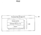
data storage unit 22, an accelerationdata storage unit 23, and a motion patterndata storage unit 24 are connected to themanagement computer 21. - As shown in FIG. 2, the positional
data storage unit 22 storespositional data 220 regarding the position of thecellular phone terminal 10. Thepositional data 220 is recorded when notification of positional information is received from thecellular phone terminal 10. In the present embodiment, thepositional data 220 is generated for each notification reception, and includes data on a terminal identifier, a notification reception time, and a position. - Data regarding an identifier assigned to the
cellular phone terminal 10 for specifying the worker who has sent the positional information is recorded in the data area for terminal identifier. In the present embodiment, the phone number of thecellular phone terminal 10 is used as the terminal identifier. - Data regarding the time at which notification of the positional information is received from the
cellular phone terminal 10 is recorded in the data area for notification reception time. - Data regarding the position of the worker at the time of notification is recorded in the data area for position. The data regarding the position of the worker is positional data obtained based on GPS signals which are received by the communication system 30 from the
cellular phone terminal 10. In the present embodiment, longitude/latitude data is used as the positional data. - As shown in FIG. 3, the acceleration
data storage unit 23stores acceleration data 230 regarding logs of accelerations applied to thecellular phone terminal 10 of the worker. Theacceleration data 230 is recorded when acceleration data is received from thecellular phone terminal 10. In the present embodiment, theacceleration data 230 is structured to include data regarding a measurement start time, a measurement end time, and an acceleration log in association with the terminal identifier. - Data regarding an identifier assigned to the
cellular pone terminal 10 which has sent the acceleration data is recorded in the data area for terminal identifier. - Data regarding the time at which the
cellular phone terminal 10 starts measuring the acceleration is recorded in the data area for measurement start time. In the present embodiment, thecellular phone terminal 10 starts measuring the acceleration in a case where thecellular phone terminal 10 can not receive GPS signals when the worker tries to perform the process for notifying the positional information, or in a case where thecellular phone terminal 10 can not communicate with the communication system 30. - Data regarding the time at which the
cellular phone terminal 10 of the worker finishes measuring the acceleration is recorded in the data area for measurement end time. In the present embodiment, thecellular phone terminal 10 finishes measuring the acceleration in a case where thecellular phone terminal 10 becomes able to receive GPS signals, and communication with the communication system 30 is recovered. - Data regarding the acceleration log received from the
cellular phone terminal 10 is recorded in the data area for acceleration log. This acceleration log includes changes in the acceleration from the measurement start time to the measurement end time. - As shown in FIG. 4, the motion pattern
data storage unit 24 pre-storesmotion pattern data 240 for specifying the means of transportation utilized by the worker. Themotion pattern data 240 indicates the characteristics of the motion pattern of each means of transportation. In the present embodiment, themotion pattern data 240 is structured to include data regarding a transportation identifier, an acceleration pattern, and a velocity pattern for each kind of transportation. - Data regarding an identifier for specifying means of transportation is stored in the data area for transportation identifier. The means of transportation includes travel means such as train, bus, airplane, etc.
- Data regarding an acceleration pattern of each means of transportation is stored in the data area for acceleration pattern. The acceleration pattern is represented by, for example, an acceleration time, etc. The acceleration time of a train is set longer than that of a bus.
- Data regarding a velocity pattern of each means of transportation is stored in the data area for velocity pattern. The velocity pattern is represented by, for example, an average velocity, a velocity range, a running time interval, etc. For example, the velocity range of a train is set wider than that of a bus. Further, since a bus may stop at a traffic light, the running time interval of a train is set longer than that of a bus.
- The
management system 20 has map data storage means (not shown) for storing map data indicative of predetermined nodes (stations, bus stops, etc.) and each means of transportation. Themanagement computer 21 of themanagement system 20 searches out a corresponding node based on predetermined positional data and/or an acceleration log received from thecellular phone terminal 10, and extracts the name of a possible means of transportation. - The processes for managing the positional information of the worker with the use of the system structured as described above, will now be explained. Explanation will be made for a notification process and for a route prediction process separately.
- First, a notification process will be explained with reference to FIG. 5. This process is executed by the
control unit 11 of thecellular phone terminal 10 in a case where the worker pushes the notification button set on thecellular phone terminal 10. - While on duty outside, the worker pushes the notification button at each point (hereinafter referred to as "node") at which the worker should notify that he/she is at the point. A node means a marking point in the travel course, and includes a place such as a station, etc. at which the worker uses a transportation service. The node includes the position of a departure station, the position of an arrival station, the position of a bus stop from which the worker gets on a bus, the position of a business partner's place, etc.
- When the notification button is pushed by the worker, the
cellular phone terminal 10 detects a communication condition (step S11). This communication condition includes a condition for receiving GPS signals and a condition for communicating with the communication system 30. Specifically, thecontrol unit 11 determines whether or not the GPSsignal reception unit 12 has received GPS signals, and whether or not thecellular phone terminal 10 is within a range accessible to the communication system 30. - In a case where GPS signals are receivable and the
cellular phone terminal 10 is within a range accessible to the communication system 30 (step S12; Yes), thecontrol unit 11 transfers the GPS signals received by the GPSsignal reception unit 12 to the communication system 30 (step S13). Data regarding the terminal identifier is affixed to the GPS signals to be transferred. - The communication system 30 specifies the position of the
cellular phone terminal 10 based on the received GPS signals, generates data (positional data) regarding the specified position. Then, the communication system 30 sends notification data including the generated positional data and the terminal identifier to themanagement computer 21 of themanagement system 20 through the network N. Themanagement computer 21 which has received the notification data adds a notification reception time thereto, and stores the terminal identifier and the positional data in the positionaldata storage unit 22. - On the contrary, in a case where the
cellular phone terminal 10 can not receive GPS signals, or in a case where the cellular phone is outside the range accessible to the communication system 30 (step S12; No), thecellular phone terminal 10 measures the acceleration by theaccelerometer 13, and starts recording data on the measured acceleration (step S14). Specifically, first, thecontrol unit 11 obtains the current time by the built-in clock, and records the obtained current time as a measurement start time in the accelerationdata storage unit 14. Next, thecontrol unit 11 starts recording data (acceleration log) on the acceleration measured by theaccelerometer 13 in the accelerationdata storage unit 14. - The
control unit 11 continues to monitor the reception condition for GPS signals and the communication condition with the communication system 30, and determines again whether or not the GPSsignal reception unit 12 has received GPS signals, and whether or not thecellular phone terminal 10 is within a range accessible to the communication system 30 (step S15). In a case where the GPSsignal reception unit 12 has still been unable to receive GPS signals or in a case where thecellular phone terminal 10 is still outside the range accessible to the communication system 30 (step S15; No), the measuring of the acceleration by theaccelerometer 13 and recording of the data are to be continued (step S16). - On the contrary, in a case where the GPS
signal reception unit 12 becomes able to receive GPS signals and thecellular phone terminal 10 enters the range accessible to the communication system 30 (step S15; Yes), thecontrol unit 11 transfers the GPS signals received by the GPSsignal reception unit 12 to the communication system 30 (step S17). In this case, the communication system 30 generates positional data regarding the position of thecellular phone terminal 10 based on the received GPS signal, and sends the generated positional data to themanagement computer 21 of themanagement system 20 through the network N. Then, themanagement computer 21 stores the terminal identifier and the positional data together with the notification reception time in the positionaldata storage unit 22. - Further, the
control unit 11 sends the acceleration data stored in the accelerationdata storage unit 14 to themanagement system 20 through the communication system 30 and the network N (step S18). The acceleration data includes data on the measurement start time and the acceleration log. - The
management computer 21 which has received the acceleration data stores the acceleration log in the accelerationdata storage unit 23 in association with the terminal identifier of thecellular phone terminal 10 which has made the notification. Further, themanagement computer 21 records the time at which it receives the acceleration log as the measurement end time. Thus, the process performed when a notification is made is completed. - When the worker returns to his/her office from the business partner's place, the worker makes a daily report including a report on the business trip, by using the
management system 20. Specifically, the worker inputs a date on which the daily report is to be made (date on which the worker has gone on a business trip), and the terminal identifier of the worker'scellular phone terminal 10, by using the input means of themanagement system 20. Then, themanagement computer 21 extracts all thepositional data 220 that include the input date and terminal identifier of the worker's terminal. - The
management computer 21 performs a process for predicting the travel route of the worker with the use of the extractedpositional data 220. This process will be explained with reference to FIG. 6. Themanagement computer 21 specifiespositional data 220 for two positions, notifications from which are received adjacently time-wise, and which are included in the prediction-target travel route (step S21). - Next, the
management computer 21 determines whether or not the positions represented by the specifiedpositional data 220 are the positions of intended nodes (step S22). A position of an intended node is a notification point at which the worker is meant to notify his/her presence, and a place where the worker pushes the notification button. In a case where the communication condition at a node is not fine, thecellular phone terminal 10 monitors the communication condition and finally makes a notification when the communication condition becomes better enough to enable communication with the communication system 30, as described in the explanation of step S17. In such a case, the position of an intended node and the position represented by thepositional data 220 do not correspond. In the present embodiment, no acceleration data is recorded in a case where the communication condition at a node is fine. Therefore, the determination for checking correspondence with the position of an intended node is done in accordance with whether or not there is acceleration data related to the position represented by the specifiedpositional data 220. Specifically, themanagement computer 21 checks whether or not there is anyacceleration data 230 indicative of a measurement end time corresponding to the notification reception time included in thepositional data 220, among theacceleration data 230 stored in association with the terminal identifier which is the target for making the daily report. - In a case where no
acceleration data 230 related to thepositional data 220 for the two positions is stored in the accelerationdata storage unit 23 and thus thepositional data 220 which are the travel route prediction target are both positional data indicative of nodes (step S22; Yes), themanagement computer 21 specifies the kind of the means of transportation (step S23). Specifically, themanagement computer 21 derives the distance between the two nodes. Then, themanagement computer 21 divides the derived distance by the time required for traveling from one of the nodes to the other, and derives the average travel velocity. Then, themanagement computer 21 specifies the kind of the means of transportation corresponding to the derived average travel velocity, based on the motion pattern data stored in the motion patterndata storage unit 24. In a case where the average travel velocity is equal to or less than a predetermined value, themanagement computer 21 determines that the travel between the two positions has been on foot, or that no substantial distance has been traveled. In this case, themanagement computer 21 does not specify the kind of the means of transportation. - On the contrary, in a case where
acceleration data 230 related to thepositional data 220 is stored in the accelerationdata storage unit 23 and thus the notification point is not the intended node (step S22, No), themanagement computer 21 predicts the position of the intended node. Specifically, themanagement computer 21 derives a distance traveled between the acceleration measurement start time and the measurement end time based on the acceleration data 230 (step S24). Here, themanagement computer 21 derives the travel distance by twice integrating the acceleration log of theacceleration data 230 with respect to time. - Next, the
management computer 21 predicts the position of the intended node based on the derived travel distance and the position at the measurement end time (notification reception time) indicated by the position data 220 (step S25). Specifically, themanagement computer 21 searches for a position that might be a node (for example, a station, a bus stop, etc.) and that exists within a circle whose center is at the position indicated by thepositional data 220 and whose radius is the derived travel distance from the map data. The map data is stored in the map data storage means (not shown) provided in themanagement system 20, as described above. - Further, the
management computer 21 specifies the kind of the means of transportation (step S26). Specifically, themanagement computer 21 compares the acceleration log stored in the accelerationdata storage unit 23 and the velocity derived from this acceleration log with the acceleration pattern and the velocity pattern stored in the motion patterndata storage unit 24, and thus specifies the kind of the means of transportation. In a case where the period of time in which the measurement has been performed is short, themanagement computer 21 may specify the kind of the means of transportation based on an average travel velocity derived from the distance between nodes, likewise step S23. - Next, the
management computer 21 specifies the travel route of the worker and outputs the specified travel route (step S27). Specifically, themanagement computer 21 extracts the name of the means of transportation which includes in its running course station names (or bust stop names, etc.) corresponding to the positions of the intended nodes (notification points) from the map data. Further, in a case where there are a plurality of means of transportation that include both the nodes, themanagement computer 21 specifies the travel route by comparing the kind of the means of transportation specified based on the acceleration log or the average travel velocity, with the name of the means of transportation extracted from the map data. Then, themanagement computer 21 outputs the specified travel route to the output means of themanagement system 20 as a candidate. Thus, the process for predicting the travel route between specific two positions is completed. This travel route prediction process is performed for all thepositional data 220 which are the targets of making the daily report. - The worker confirms the candidate of the travel route which is output. In a case where the worker confirms the candidate to be correct, the candidate is settled as the correct travel route based on the confirmation information. Then, the daily report is made based on this travel route.
- As explained above, in the present embodiment, the following effects can be achieved.
- (1) In the above embodiment, in a case where the
cellular phone terminal 10 can not receive GPS signals, or in a case where thecellular phone terminal 10 is outside the range accessible to the communication system 30, thecellular phone terminal 10 starts recording acceleration data indicative of the acceleration measured by theaccelerometer 13. Therefore, even in a case where the communication condition of thecellular phone terminal 10 is not fine, the travel route of the worker can be predicted using the acceleration data. - (2) In the above embodiment, in a case where the notification button is
pushed at each node, the
cellular phone terminal 10 sends positional data to themanagement system 20. Therefore, it is possible to provide positional information to themanagement system 20 efficiently by reducing the communication frequency. - (3) In the above embodiment, in a case where the communication
condition at the time the notification button is pushed is not fine, the
control unit 11 monitors the condition for receiving GPS signals and the condition for communicating with the communication system 30. Then, when the communication condition is improved, thus GPS signals can be received, and communication with the communication system 30 becomes possible, thecontrol unit 11 sends the acceleration data stored in the accelerationdata storage unit 14 to themanagement system 20 through the communication system 30 and the network N. Therefore, thecellular phone terminal 10 only needs to record acceleration data during a period of time in which the communication condition is not desirable. Accordingly, the storage capacity of the accelerationdata storage unit 14 can be reduced. - (4) In the above embodiment,
acceleration data 230 regarding a log of an acceleration applied to thecellular phone terminal 10 is stored in the accelerationdata storage unit 23. Theacceleration data 230 is data on an acceleration during a period of time in which the communication condition remains undesirable since the notification button of thecellular phone terminal 10 is pushed. Therefore, themanagement computer 21 can predict the position of the intended node using thepositional data 220 stored in the positionaldata storage unit 22 and theacceleration data 230. Accordingly, a candidate of the travel route can be specified using the predicted nodes. By using the candidate of the travel route, the worker can efficiently make a daily report or business trip report. - (5) In the above embodiment,
motion pattern data 240 for specifying means of transportation is stored in the motion patterndata storage unit 24. Themotion pattern data 240 includes data on a transportation identifier, an acceleration pattern, and a velocity pattern for each means of transportation. Therefore, means of transportation can be specified based on the acceleration log of theacceleration data 230 and a calculated average travel velocity. -
- The present invention is not limited to the above-described embodiment, but can be arbitrarily applied and modified.
- For example, in the above embodiment, as has been explained, in a case where the
cellular phone terminal 10 can not receive GPS signals or in a case where thecellular phone terminal 10 is outside the range accessible to the communication system 30, thecellular phone terminal 10 starts recording acceleration data. Instead, thecellular phone terminal 10 may record acceleration data all the time. Thereby, it is possible to specify the means of transportation more securely by using themotion pattern data 240 stored in the motion patterndata storage unit 24. - As has been explained, in the above embodiment, when the notification button is pushed at each node, the
cellular phone terminal 10 sends positional data to themanagement system 20. In addition, thecellular phone terminal 10 may send positional data to themanagement system 20 while on the move. This modification example will now be explained with reference to FIG. 7. - In this modification example, the
control unit 11 is supposed to measure the acceleration by theaccelerometer 13 all the time and record data representing the measured acceleration in the accelerationdata storage unit 14. Thecontrol unit 11 calculates the average velocity by once integrating the acceleration measured by theaccelerometer 13 with respect to time (step S31). - Next, the
control unit 11 determines a notification cycle according to which positional data should be notified to themanagement system 20, in accordance with the average velocity (step S32). In this case, thecontrol unit 11 derives the notification cycle using a function in which the average velocity is a parameter. That is, the average velocity is calculated as a function of the acceleration, and the notification cycle is calculated as a function of the average velocity. Here, as a function for calculating the notification cycle, a function according to which the notification cycle becomes shorter as the average velocity increases, is used. In this way, thecontrol unit 11 can calculate the notification cycle as the function of the acceleration, based on the measured acceleration - Next, the
control unit 11 compares the time which has elapsed from the latest notification time with the calculated notification cycle (step S33). In a case where the elapsing time is shorter than the notification cycle (step S33; No), thecontrol unit 11 repeats steps S31 to S33. - On the contrary, in a case where the elapsing time becomes equal to or greater than the notification cycle (step S33; Yes), the
control unit 11 sends a notification signal for requesting forwarding of positional information, to the communication system 30 while on the move (step S34). This notification signal includes GPS signals received by the GPSsignal reception unit 12. The communication system 30, which has received the notification signal sent while on the move, generates positional data of thecellular phone terminal 10 based on the received GPS signal, and forwards the generated positional data to themanagement system 20. - Since the
management computer 21 of themanagement system 20 can specify an intermediate position between nodes by this notification sent while on the move, themanagement computer 21 can specify the worker's travel route more securely. - Further, since a function according to which the notification cycle becomes shorter as the average velocity increases is used, in a case where the worker moves at a high velocity, notifications while the worker is on the move are sent frequently. On the other hand, while the worker is stopping or moving at a low velocity, notifications while the worker is on the move become less frequent. Therefore, positional information can be recorded in accordance with a predetermined travel distance. This enables efficient data recording.
- According to the explanation of the above-described embodiment, in a case where the
cellular phone terminal 10 becomes able to receive GPS signals and in a case where thecellular phone terminal 10 enters the range accessible to the communication system 30, thecontrol unit 11 sends the acceleration data stored in the accelerationdata storage unit 14 to themanagement system 20 through the communication system 30 and the network N. Instead of this, the worker may directly transfer the acceleration data stored in the accelerationdata storage unit 14 of thecellular phone terminal 10 to the accelerationdata storage unit 23 of themanagement computer 21 when the worker returns to the office. Due to this, communication costs can be reduced. - According to the explanation of the above-described embodiment, the communication system 30 specifies the position of the
cellular phone terminal 10 based on, for example, the principle of triangulation using GPS signals from a plurality of GPS satellites transferred from thecellular phone terminal 10. However, the position specifying method using GPS signals is not limited to this, but is arbitrary. For example, a so-called D-GPS (Differential-Global Positioning System) for correcting the measured position based on errors with respect to the GPS satellites may be employed. Further, a position specifying function of the wireless base station constituting the communication system 30 may be additionally used, so that the position of thecellular phone terminal 10 can be specified more precisely. - As explained above, according to the present invention, it is possible to efficiently manage the positional information of a worker who moves from place to place toward visiting destinations where he/she has works to do. Further, the worker can carry out his/her works efficiently because the worker can use the positional information which he/she has sent, when making a daily report.
- The above-described embodiments are intended to illustrate the present invention, not to limit the scope of the present invention. Other than the disclosed embodiments, various embodiments and various usages will become apparent to those skilled in the art upon studying the above described embodiments. The scope of the present invention is shown by the attached claims rather than the embodiments. Various modifications made within the meaning of an equivalent of the claims of the invention and within the claims are to be regarded to be in the scope of the present invention.
Claims (12)
- A positional information management system characterized by comprising: a mobile terminal which acquires acceleration data at a predetermined position; a management server which is connected to said mobile terminal through a network and predicts a travel route of said mobile terminal; and a communication system which specifies a current position of said mobile terminal and sends positional data representing the specified current position to said management server,
characterized in that said management server (21):is connected to a positional data storage unit (22) which stores positional data representing that said mobile terminal (10) is at a predetermined position, which is sent from said communication system (30) in association with a reception time at which the positional data is received, and to an acceleration data storage unit (23) which stores an acceleration log representing acceleration data in time series, which is sent from said mobile terminal (10) in association with a reception time at which the acceleration log is received;selects positional data for two positions which are recorded adjacently time-wise in said positional data storage unit (22), and which are included in a travel route which is a target of prediction;extracts an acceleration log whose reception time corresponds to a reception time of any of the selected positional data; andpredicts a travel route of said mobile terminal (10) based on the selected positional data and the extracted acceleration log. - The positional information management system according to claim 1,
characterized in that said management server (21):is further connected to a motion pattern data storage unit (24) which stores a velocity pattern and an acceleration pattern for each means of transportation; andspecifies means of transportation used for traveling between the two positions, by deriving an average travel velocity between the two positions based on the selected positional data and their reception times and then comparing the average travel velocity with the velocity pattern stored in said motion pattern data storage unit (24), or by comparing the extracted acceleration log with the acceleration pattern stored in said motion pattern data storage unit (24). - A positional information management method for predicting a travel route from a notification point at which a mobile terminal should notify that it is at the point, based on positional data representing a current position of said mobile terminal which acquires acceleration data at a predetermined position, and an acceleration log representing acceleration data in time series acquired by said mobile terminal, the positional data and the acceleration log being notified through a predetermined network, said method characterized by comprising:a step of storing positional data and an'acceleration log in association with times at which they are notified;a step (S21) of selecting positional data for two positions which are recorded adjacently time-wise, and which are included in a travel route which is a target of prediction;a step of extracting an acceleration log corresponding to any of the selected positional data; anda step (S27) of predicting a travel route based on the selected positional data and the extracted acceleration log.
- The positional information management method according to claim 3, characterized by further comprising a step of storing map data representing predetermined means of transportation, and places to get on and off the means of transportation,
characterized in that:the notification point includes the places to get on and off the means of transportation; andsaid step (S27) of predicting the travel route includes specifying means of transportation which includes the notification point in its running course, by using the map data. - The positional information management method according to claim 3, characterized in that said step (S27) of predicting the travel route includes:a step (S25) of specifying the notification point based on the extracted acceleration log corresponding to the selected positional data and the selected positional data, in a case where any of the selected positional data is not positional data representing the notification point (S22); anda step (S23, S26) of predicting the travel route based on positional data representing the notification point or based on the extracted acceleration log.
- The positional information management method according to claim 5, characterized in that said step (S25) of specifying the notification point specifies the notification point by:deriving a travel distance based on the extracted acceleration log (S24); andsearching for the notification point that exists within a radius of the derived travel distance from the position represented by the selected positional data from the map data.
- The positional information management method according to claim 3, characterized by further comprising a step of storing a velocity pattern for each predetermined means of transportation,
characterized in that said step (S27) of predicting the travel route specifies means of transportation by calculating an average travel velocity between the two positions based on the selected positional data and the times at which the positional data are notified, and by comparing the average travel velocity with the velocity pattern (S23). - The positional information management method according to claim 3, characterized by further comprising a step of storing an acceleration pattern for each predetermined means of transportation,
characterized in that said step (S27) of predicting the travel route specifies means of transportation by comparing the extracted acceleration log with the acceleration pattern (S26). - A computer-readable recording medium characterized by storing a program for controlling a computer to execute all or a part of the steps of the positional information management method according to any one of claims 3 to 8.
- A carrier wave characterized by being able to be run on a computer and by carrying a program for controlling a computer to execute all or a part of the steps of the positional information management method according to any one of claims 3 to 8.
- A mobile terminal characterized by comprising: an acceleration measuring unit which senses an acceleration and measures an acceleration log; a positional information acquiring unit which acquires predetermined positional information; a control unit which controls said acceleration measuring unit and said positional information acquiring unit; and a storage unit which stores predetermined data, and which sends predetermined information to a management system for managing the positional information,
characterized in that said control unit (11):determines whether or not data for specifying a position of said mobile terminal (10) can be acquired by said positional information acquiring unit (12);stores an acceleration log measured by said acceleration measuring unit (13) in said storage unit (14), in a case where the positional information can not be acquired; andsends data regarding the position of said mobile terminal (10) acquired by said positional information acquiring unit (12) and the acceleration log stored in said storage unit (14) to said management system (20), in a case where acquisition of the positional information becomes possible. - The mobile terminal according to claim 11,
characterized in that said control unit (11) further:derives a time cycle as a function of an acceleration measured by said acceleration measuring unit (13); andsends data regarding the position of said mobile terminal (10) to said management system (20) in accordance with the time cycle.
Applications Claiming Priority (2)
| Application Number | Priority Date | Filing Date | Title |
|---|---|---|---|
| JP2002112361A JP3905412B2 (en) | 2002-04-15 | 2002-04-15 | Location information management method, location information management program, and mobile terminal |
| JP2002112361 | 2002-04-15 |
Publications (2)
| Publication Number | Publication Date |
|---|---|
| EP1355283A1 true EP1355283A1 (en) | 2003-10-22 |
| EP1355283B1 EP1355283B1 (en) | 2008-01-09 |
Family
ID=28672579
Family Applications (1)
| Application Number | Title | Priority Date | Filing Date |
|---|---|---|---|
| EP03008034A Expired - Fee Related EP1355283B1 (en) | 2002-04-15 | 2003-04-11 | Positional information management system and method |
Country Status (5)
| Country | Link |
|---|---|
| US (1) | US7640268B2 (en) |
| EP (1) | EP1355283B1 (en) |
| JP (1) | JP3905412B2 (en) |
| DE (1) | DE60318513T2 (en) |
| ES (1) | ES2299640T3 (en) |
Cited By (5)
| Publication number | Priority date | Publication date | Assignee | Title |
|---|---|---|---|---|
| CN101141820B (en) * | 2007-10-22 | 2010-11-10 | 中兴通讯股份有限公司 | 3G network card location implementing method, device and system |
| EP2426511A1 (en) * | 2010-09-02 | 2012-03-07 | Casio Computer Co., Ltd. | Positioning apparatus and positioning method |
| US8718619B2 (en) | 2009-04-28 | 2014-05-06 | Telefonaktiebolaget L M Ericsson (Publ) | Predicting presence of a mobile user equipment |
| CN104077827A (en) * | 2014-06-30 | 2014-10-01 | 北京融安特智能科技有限公司 | Intelligent storehouse system |
| CN105066989A (en) * | 2015-06-30 | 2015-11-18 | 上海恺希机器人有限公司 | Positioning apparatus |
Families Citing this family (31)
| Publication number | Priority date | Publication date | Assignee | Title |
|---|---|---|---|---|
| US8352400B2 (en) | 1991-12-23 | 2013-01-08 | Hoffberg Steven M | Adaptive pattern recognition based controller apparatus and method and human-factored interface therefore |
| US10361802B1 (en) | 1999-02-01 | 2019-07-23 | Blanding Hovenweep, Llc | Adaptive pattern recognition based control system and method |
| US7966078B2 (en) | 1999-02-01 | 2011-06-21 | Steven Hoffberg | Network media appliance system and method |
| US11033821B2 (en) * | 2003-09-02 | 2021-06-15 | Jeffrey D. Mullen | Systems and methods for location based games and employment of the same on location enabled devices |
| US7627549B1 (en) * | 2005-12-16 | 2009-12-01 | At&T Corp. | Methods and systems for transferring data over electronics networks |
| US9958934B1 (en) | 2006-05-01 | 2018-05-01 | Jeffrey D. Mullen | Home and portable augmented reality and virtual reality video game consoles |
| JP4770684B2 (en) * | 2006-10-03 | 2011-09-14 | 株式会社デンソー | Inter-vehicle communication system |
| JP4894484B2 (en) * | 2006-11-29 | 2012-03-14 | 株式会社Jvcケンウッド | Mobile station apparatus, position management system thereof, and method of providing position correction information thereof |
| US9418366B1 (en) * | 2007-03-30 | 2016-08-16 | Google Inc. | Ad payment for physical presence |
| WO2008142783A1 (en) * | 2007-05-23 | 2008-11-27 | Navitime Japan Co., Ltd. | Navigation system, route retrieval server and mobile terminal device, and route guiding method |
| US20090005974A1 (en) * | 2007-06-29 | 2009-01-01 | Gm Global Technology Operations, Inc. | Fuel cost predictor system |
| KR20090004060A (en) * | 2007-07-06 | 2009-01-12 | 엘지전자 주식회사 | Telematics terminal capable of receiving broadcast and method of processing broadcast signal |
| US8015144B2 (en) | 2008-02-26 | 2011-09-06 | Microsoft Corporation | Learning transportation modes from raw GPS data |
| US8972177B2 (en) | 2008-02-26 | 2015-03-03 | Microsoft Technology Licensing, Llc | System for logging life experiences using geographic cues |
| US8966121B2 (en) * | 2008-03-03 | 2015-02-24 | Microsoft Corporation | Client-side management of domain name information |
| CA2724547A1 (en) * | 2008-05-20 | 2009-11-26 | Telefonaktiebolaget Lm Ericsson (Publ) | Method of controlling user equipment in wireless telecommunications network |
| JP2010034904A (en) * | 2008-07-29 | 2010-02-12 | Kyocera Corp | Mobile terminal device |
| JP2010151459A (en) * | 2008-12-24 | 2010-07-08 | Seiko Epson Corp | Method and device for calculating position |
| US9063226B2 (en) | 2009-01-14 | 2015-06-23 | Microsoft Technology Licensing, Llc | Detecting spatial outliers in a location entity dataset |
| US9009177B2 (en) | 2009-09-25 | 2015-04-14 | Microsoft Corporation | Recommending points of interests in a region |
| US9261376B2 (en) | 2010-02-24 | 2016-02-16 | Microsoft Technology Licensing, Llc | Route computation based on route-oriented vehicle trajectories |
| US10288433B2 (en) * | 2010-02-25 | 2019-05-14 | Microsoft Technology Licensing, Llc | Map-matching for low-sampling-rate GPS trajectories |
| US9593957B2 (en) | 2010-06-04 | 2017-03-14 | Microsoft Technology Licensing, Llc | Searching similar trajectories by locations |
| CN102740390B (en) * | 2011-04-12 | 2015-01-28 | 中兴通讯股份有限公司 | Machine-to-machine/man (M2M) system and communication method thereof, M2M platform and terminal |
| US9754226B2 (en) | 2011-12-13 | 2017-09-05 | Microsoft Technology Licensing, Llc | Urban computing of route-oriented vehicles |
| US20130166188A1 (en) | 2011-12-21 | 2013-06-27 | Microsoft Corporation | Determine Spatiotemporal Causal Interactions In Data |
| CN102651101B (en) * | 2012-04-06 | 2015-06-10 | 北京融安特智能科技有限公司 | Movable rack-based integrated archives management system |
| KR101860540B1 (en) * | 2012-04-26 | 2018-05-23 | 한국전자통신연구원 | Portable terminal and method for sharing location information between users |
| JP5760073B2 (en) * | 2013-12-18 | 2015-08-05 | 本田技研工業株式会社 | Traffic information processing equipment |
| JP6072669B2 (en) * | 2013-12-19 | 2017-02-01 | 三菱電機株式会社 | Patrol work support system |
| CN103810851B (en) * | 2014-01-23 | 2015-10-21 | 广州地理研究所 | A kind of traffic trip mode identification method based on mobile phone location |
Citations (2)
| Publication number | Priority date | Publication date | Assignee | Title |
|---|---|---|---|---|
| US5652570A (en) * | 1994-05-19 | 1997-07-29 | Lepkofker; Robert | Individual location system |
| GB2322248A (en) * | 1997-02-06 | 1998-08-19 | Fujitsu Ltd | Position determination, processing and display |
Family Cites Families (28)
| Publication number | Priority date | Publication date | Assignee | Title |
|---|---|---|---|---|
| AU4643297A (en) * | 1996-06-03 | 1998-01-07 | Mcdonnell Douglas Helicopter Company | Portable flight guidance and tracking system |
| JP3591759B2 (en) * | 1997-02-06 | 2004-11-24 | 富士通株式会社 | Position information management system, position information management device, and information terminal |
| JP3206477B2 (en) * | 1997-02-19 | 2001-09-10 | トヨタ自動車株式会社 | Mobile terminal device |
| US6252544B1 (en) * | 1998-01-27 | 2001-06-26 | Steven M. Hoffberg | Mobile communication device |
| US6144917A (en) * | 1998-10-30 | 2000-11-07 | Garmin Corporation | Calculation of estimated time of arrival (ETA) based on thoroughfare classification and driving history |
| DE60010993T2 (en) * | 1999-08-17 | 2005-06-09 | Toyota Jidosha K.K., Toyota | Route guidance device |
| US20020022924A1 (en) * | 2000-03-07 | 2002-02-21 | Begin John David | Propagation of position with multiaxis accelerometer |
| JP2001282974A (en) * | 2000-03-29 | 2001-10-12 | Ricoh Co Ltd | System and device for managing work and recording medium |
| JP3783525B2 (en) * | 2000-05-18 | 2006-06-07 | 株式会社デンソー | Average vehicle speed calculation device and recording medium |
| JP2002015102A (en) * | 2000-06-30 | 2002-01-18 | Matsushita Electric Ind Co Ltd | Business management system |
| US6421608B1 (en) * | 2000-07-12 | 2002-07-16 | Ricoh Company Limited | Method and system of remote position reporting device |
| JP2002048589A (en) * | 2000-08-03 | 2002-02-15 | Tohoku Denshi Sangyo Kk | Moving route estimation device for mobile |
| US6496778B1 (en) * | 2000-09-14 | 2002-12-17 | American Gnc Corporation | Real-time integrated vehicle positioning method and system with differential GPS |
| US6857016B1 (en) * | 2000-09-25 | 2005-02-15 | Ricoh Company Limited | Method and system of data collection and mapping from a remote position reporting device |
| US6826477B2 (en) * | 2001-04-23 | 2004-11-30 | Ecole Polytechnique Federale De Lausanne (Epfl) | Pedestrian navigation method and apparatus operative in a dead reckoning mode |
| US6728632B2 (en) * | 2001-08-30 | 2004-04-27 | Ericsson Inc. | Navigation devices, systems, and methods for determining location, position, and/or orientation information based on movement data generated by a movement detector |
| US7277558B2 (en) * | 2001-11-27 | 2007-10-02 | Lockheed Martin Corporation | Method and system for estimating the position of moving objects in images |
| US6697736B2 (en) * | 2002-02-06 | 2004-02-24 | American Gnc Corporation | Positioning and navigation method and system thereof |
| US7730063B2 (en) * | 2002-12-10 | 2010-06-01 | Asset Trust, Inc. | Personalized medicine service |
| JP2003248488A (en) * | 2002-02-22 | 2003-09-05 | Ricoh Co Ltd | System, device and method for information processing, and program |
| US6801159B2 (en) * | 2002-03-19 | 2004-10-05 | Motorola, Inc. | Device for use with a portable inertial navigation system (“PINS”) and method for transitioning between location technologies |
| US20030206100A1 (en) * | 2002-05-04 | 2003-11-06 | Lawrence Richman | Method and protocol for real time security system |
| US7499949B2 (en) * | 2002-08-07 | 2009-03-03 | Navteq North America, Llc | Method and system for obtaining recurring delay data using navigation systems |
| US6876926B2 (en) * | 2002-09-26 | 2005-04-05 | Honeywell International Inc. | Method and system for processing pulse signals within an inertial navigation system |
| US6883747B2 (en) * | 2003-03-28 | 2005-04-26 | Northrop Grumman Corporation | Projectile guidance with accelerometers and a GPS receiver |
| US7577636B2 (en) * | 2003-05-28 | 2009-08-18 | Fernandez Dennis S | Network-extensible reconfigurable media appliance |
| US20050091184A1 (en) * | 2003-10-24 | 2005-04-28 | Praveen Seshadri | Personalized folders |
| US7707039B2 (en) * | 2004-02-15 | 2010-04-27 | Exbiblio B.V. | Automatic modification of web pages |
-
2002
- 2002-04-15 JP JP2002112361A patent/JP3905412B2/en not_active Expired - Fee Related
-
2003
- 2003-04-11 DE DE60318513T patent/DE60318513T2/en not_active Expired - Lifetime
- 2003-04-11 US US10/411,210 patent/US7640268B2/en not_active Expired - Fee Related
- 2003-04-11 ES ES03008034T patent/ES2299640T3/en not_active Expired - Lifetime
- 2003-04-11 EP EP03008034A patent/EP1355283B1/en not_active Expired - Fee Related
Patent Citations (2)
| Publication number | Priority date | Publication date | Assignee | Title |
|---|---|---|---|---|
| US5652570A (en) * | 1994-05-19 | 1997-07-29 | Lepkofker; Robert | Individual location system |
| GB2322248A (en) * | 1997-02-06 | 1998-08-19 | Fujitsu Ltd | Position determination, processing and display |
Cited By (6)
| Publication number | Priority date | Publication date | Assignee | Title |
|---|---|---|---|---|
| CN101141820B (en) * | 2007-10-22 | 2010-11-10 | 中兴通讯股份有限公司 | 3G network card location implementing method, device and system |
| US8718619B2 (en) | 2009-04-28 | 2014-05-06 | Telefonaktiebolaget L M Ericsson (Publ) | Predicting presence of a mobile user equipment |
| EP2426511A1 (en) * | 2010-09-02 | 2012-03-07 | Casio Computer Co., Ltd. | Positioning apparatus and positioning method |
| US8700355B2 (en) | 2010-09-02 | 2014-04-15 | Casio Computer Co., Ltd. | Positioning apparatus judging moving method to control positioning timing |
| CN104077827A (en) * | 2014-06-30 | 2014-10-01 | 北京融安特智能科技有限公司 | Intelligent storehouse system |
| CN105066989A (en) * | 2015-06-30 | 2015-11-18 | 上海恺希机器人有限公司 | Positioning apparatus |
Also Published As
| Publication number | Publication date |
|---|---|
| US20030217070A1 (en) | 2003-11-20 |
| DE60318513D1 (en) | 2008-02-21 |
| DE60318513T2 (en) | 2009-01-08 |
| US7640268B2 (en) | 2009-12-29 |
| JP3905412B2 (en) | 2007-04-18 |
| ES2299640T3 (en) | 2008-06-01 |
| JP2003309653A (en) | 2003-10-31 |
| EP1355283B1 (en) | 2008-01-09 |
Similar Documents
| Publication | Publication Date | Title |
|---|---|---|
| EP1355283B1 (en) | Positional information management system and method | |
| JP4568641B2 (en) | Wireless communication system, node position calculation method, and node | |
| JP4824758B2 (en) | Dynamic position almanac for radio base stations | |
| JP3984922B2 (en) | Mobile device, server device, and information providing method | |
| US8340904B2 (en) | Transmission of wireless messages of current vehicle location and estimated arrival time to requestors | |
| AU775765B2 (en) | Method and system for location management and location information providing system | |
| US9949079B2 (en) | Method of and system for estimating position | |
| CN101098276B (en) | Location-based tuning services method and system for wireless lan devices | |
| KR102604366B1 (en) | System and method for location measurement | |
| US20070049289A1 (en) | Location based service system and position information updating method thereof | |
| US9369846B1 (en) | Transmission of wireless messages of current vehicle location and estimated arrival time to requestors | |
| JP2011509028A (en) | Providing Wi-Fi location information to mobile devices to estimate the location of mobile devices | |
| US20100151789A1 (en) | Communication system, wireless communication terminal device, position estimation device, communication relay device and connecting station | |
| JP2006189415A (en) | Method and system for determining minimum time route | |
| CN114286283B (en) | Method, node and terminal for providing location information of terminal in communication network | |
| KR100726567B1 (en) | Method for providing information service based on location and geographic information | |
| CN109076374A (en) | Electronic device and method in mobile base station | |
| US9736643B2 (en) | Wireless communication devices carry out processes to request vehicle location and arrival time | |
| US20160066156A1 (en) | Selection of Location-Determination Information | |
| JP4755031B2 (en) | Location management method, communication method, communication system, and location information providing system | |
| Gikas et al. | Collaborative positioning for urban intelligent transportation systems (ITS) and personal mobility (PM): Challenges and perspectives | |
| KR20120013495A (en) | System and Apparatus for Positioning, and Method therefor | |
| JP6223302B2 (en) | Apparatus, program, and method capable of determining stay of user having portable terminal | |
| JP4584299B2 (en) | Position management system, position management method, and management apparatus | |
| US20220057809A1 (en) | Method and Apparatus for Predicting Demand for Personal Mobility Vehicle and Redistributing Personal Mobility Vehicle |
Legal Events
| Date | Code | Title | Description |
|---|---|---|---|
| PUAI | Public reference made under article 153(3) epc to a published international application that has entered the european phase |
Free format text: ORIGINAL CODE: 0009012 |
|
| 17P | Request for examination filed |
Effective date: 20030714 |
|
| AK | Designated contracting states |
Kind code of ref document: A1 Designated state(s): AT BE BG CH CY CZ DE DK EE ES FI FR GB GR HU IE IT LI LU MC NL PT SE SI SK TR |
|
| AX | Request for extension of the european patent |
Extension state: AL LT LV MK RO |
|
| AKX | Designation fees paid |
Designated state(s): DE ES FR GB IT NL |
|
| 17Q | First examination report despatched |
Effective date: 20041201 |
|
| GRAP | Despatch of communication of intention to grant a patent |
Free format text: ORIGINAL CODE: EPIDOSNIGR1 |
|
| GRAS | Grant fee paid |
Free format text: ORIGINAL CODE: EPIDOSNIGR3 |
|
| GRAA | (expected) grant |
Free format text: ORIGINAL CODE: 0009210 |
|
| AK | Designated contracting states |
Kind code of ref document: B1 Designated state(s): DE ES FR GB IT NL |
|
| REG | Reference to a national code |
Ref country code: GB Ref legal event code: FG4D |
|
| REF | Corresponds to: |
Ref document number: 60318513 Country of ref document: DE Date of ref document: 20080221 Kind code of ref document: P |
|
| REG | Reference to a national code |
Ref country code: ES Ref legal event code: FG2A Ref document number: 2299640 Country of ref document: ES Kind code of ref document: T3 |
|
| ET | Fr: translation filed | ||
| PLBE | No opposition filed within time limit |
Free format text: ORIGINAL CODE: 0009261 |
|
| STAA | Information on the status of an ep patent application or granted ep patent |
Free format text: STATUS: NO OPPOSITION FILED WITHIN TIME LIMIT |
|
| 26N | No opposition filed |
Effective date: 20081010 |
|
| REG | Reference to a national code |
Ref country code: FR Ref legal event code: PLFP Year of fee payment: 14 |
|
| REG | Reference to a national code |
Ref country code: FR Ref legal event code: PLFP Year of fee payment: 15 |
|
| PGFP | Annual fee paid to national office [announced via postgrant information from national office to epo] |
Ref country code: NL Payment date: 20170419 Year of fee payment: 15 |
|
| PGFP | Annual fee paid to national office [announced via postgrant information from national office to epo] |
Ref country code: GB Payment date: 20170419 Year of fee payment: 15 Ref country code: DE Payment date: 20170419 Year of fee payment: 15 Ref country code: FR Payment date: 20170419 Year of fee payment: 15 |
|
| PGFP | Annual fee paid to national office [announced via postgrant information from national office to epo] |
Ref country code: ES Payment date: 20170517 Year of fee payment: 15 Ref country code: IT Payment date: 20170424 Year of fee payment: 15 |
|
| REG | Reference to a national code |
Ref country code: DE Ref legal event code: R119 Ref document number: 60318513 Country of ref document: DE |
|
| REG | Reference to a national code |
Ref country code: NL Ref legal event code: MM Effective date: 20180501 |
|
| GBPC | Gb: european patent ceased through non-payment of renewal fee |
Effective date: 20180411 |
|
| PG25 | Lapsed in a contracting state [announced via postgrant information from national office to epo] |
Ref country code: NL Free format text: LAPSE BECAUSE OF NON-PAYMENT OF DUE FEES Effective date: 20180501 Ref country code: DE Free format text: LAPSE BECAUSE OF NON-PAYMENT OF DUE FEES Effective date: 20181101 |
|
| PG25 | Lapsed in a contracting state [announced via postgrant information from national office to epo] |
Ref country code: GB Free format text: LAPSE BECAUSE OF NON-PAYMENT OF DUE FEES Effective date: 20180411 |
|
| PG25 | Lapsed in a contracting state [announced via postgrant information from national office to epo] |
Ref country code: FR Free format text: LAPSE BECAUSE OF NON-PAYMENT OF DUE FEES Effective date: 20180430 Ref country code: IT Free format text: LAPSE BECAUSE OF NON-PAYMENT OF DUE FEES Effective date: 20180411 |
|
| REG | Reference to a national code |
Ref country code: ES Ref legal event code: FD2A Effective date: 20190912 |
|
| PG25 | Lapsed in a contracting state [announced via postgrant information from national office to epo] |
Ref country code: ES Free format text: LAPSE BECAUSE OF NON-PAYMENT OF DUE FEES Effective date: 20180412 |